Approximate Location Map
Large Map »
Latitude: 55.9412 / 55°56'28"N
Longitude: -3.1834 / 3°11'0"W
OS Eastings: 326177
OS Northings: 672651
OS Grid: NT261726
Mapcode National: GBR 8QK.NQ
Mapcode Global: WH6SM.2XCR
Plus Code: 9C7RWRR8+FJ
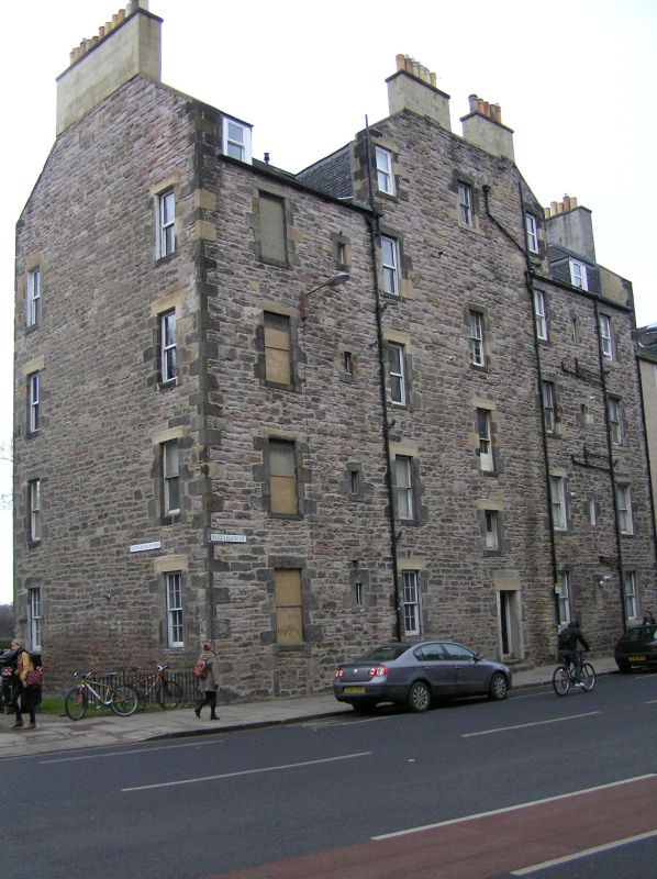
Entry Name: 130 Buccleuch Street, Edinburgh
Listing Name: 130 Buccleuch Street, Hope Park End
Listing Date: 12 December 1974
Category: B
Source: Historic Scotland
Source ID: 366239
Historic Scotland Designation Reference: LB28404
Building Class: Cultural
ID on this website: 200366239
Location: Edinburgh
County: Edinburgh
Town: Edinburgh
Electoral Ward: Southside/Newington
Traditional County: Midlothian
Tagged with: Architectural structure
1780/1804. 4-storey and attic rubble-built, 5-window with 3-window 2-chimneyed wallhead gable to Buccleuch Street, 2 linked wallhead gables at back towards Meadows, 'Hope Park End' inscribed on gable.
External links are from the relevant listing authority and, where applicable, Wikidata. Wikidata IDs may be related buildings as well as this specific building. If you want to add or update a link, you will need to do so by editing the Wikidata entry.


Other nearby listed buildings
