Approximate Location Map
Large Map »
Latitude: 55.9479 / 55°56'52"N
Longitude: -3.1954 / 3°11'43"W
OS Eastings: 325444
OS Northings: 673407
OS Grid: NT254734
Mapcode National: GBR 8NH.7B
Mapcode Global: WH6SL.WRKM
Plus Code: 9C7RWRX3+5R
Entry Name: 74-78 Grassmarket, Edinburgh
Listing Name: 74-84 (Even Nos) Grassmarket
Listing Date: 14 December 1970
Category: B
Source: Historic Scotland
Source ID: 367828
Historic Scotland Designation Reference: LB28942
Building Class: Cultural
ID on this website: 200367828
Location: Edinburgh
County: Edinburgh
Town: Edinburgh
Electoral Ward: City Centre
Traditional County: Midlothian
Tagged with: Tenement
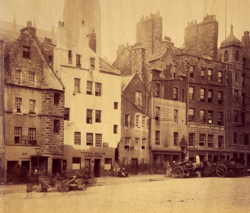
17th century (dated 1634), rebuilt 1929-30, Ebebezer J MacRae. 4-storey and attic 5-bay tenement with public house to ground floor; lower advanced stair tower to centre. Random rubble. Relieving arches to 1st and 2nd floor windows. Taller 2 bay block to left: steep roof with piend-roofed dormer; crowstepped gable to right. Lower 2 bay block to right with catslide roof: crowstepped dormerhead to 3rd floor breaking eaves; small window in gable. Projecting stair tower: rollmoulded doorway; original lintel stone (see Notes); moulded string course to 1st and 2nd floors. Modern front to public house.
12-pane glazing in timber sash and case windows. Corniced ashlar end stacks with circular cans. Graded grey slates
Lintel (now very worn) dated 1634 and inscribed 'Blessed be God for all his Giftis' between initials IL and GK, standing for James Lightbodie and his wife Geillis, daughter of Walter Kniblo. Old photographs (NMRS) show that the elevation was drastically altered for the City by MacRae, moving the stair tower to the centre and widening it, narrowing the 2 bays to left and right, and removing the wallhead chimney of that to left. The long rectangle of Grassmarket was already a suburb and a secondary market place by 1500. After the Battle of Flodden in 1513 the city walls were strengthened and the Grassmarket and Cowgate enclosed by the Flodden Wall. Agricultural produce was sold in the Grassmarket until well into the 20th century; old photographs show up-ended carts and the bars and hostels associated with the market. It was also a place of public execution.
External links are from the relevant listing authority and, where applicable, Wikidata. Wikidata IDs may be related buildings as well as this specific building. If you want to add or update a link, you will need to do so by editing the Wikidata entry.


Other nearby listed buildings
