Approximate Location Map
Large Map »
Latitude: 55.945 / 55°56'42"N
Longitude: -3.1837 / 3°11'1"W
OS Eastings: 326167
OS Northings: 673074
OS Grid: NT261730
Mapcode National: GBR 8QJ.LC
Mapcode Global: WH6SM.2T6V
Plus Code: 9C7RWRW8+2G
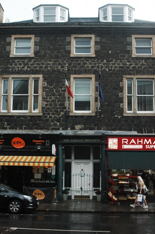
Entry Name: 82-84 Nicolson Street, Edinburgh
Listing Name: Nicolson Street, 80-84
Listing Date: 12 December 1974
Category: B
Source: Historic Scotland
Source ID: 369301
Historic Scotland Designation Reference: LB29421
Building Class: Cultural
ID on this website: 200369301
Early 19th century: 3-storey and attic, 3-window ground
floor as shops: squared rubble with pinnings: outer windows
at 1st floor tripartite.
External links are from the relevant listing authority and, where applicable, Wikidata. Wikidata IDs may be related buildings as well as this specific building. If you want to add or update a link, you will need to do so by editing the Wikidata entry.


Other nearby listed buildings
