Approximate Location Map
Large Map »
Latitude: 55.9446 / 55°56'40"N
Longitude: -3.185 / 3°11'5"W
OS Eastings: 326087
OS Northings: 673029
OS Grid: NT260730
Mapcode National: GBR 8QJ.BJ
Mapcode Global: WH6SM.1VM5
Plus Code: 9C7RWRV8+R2
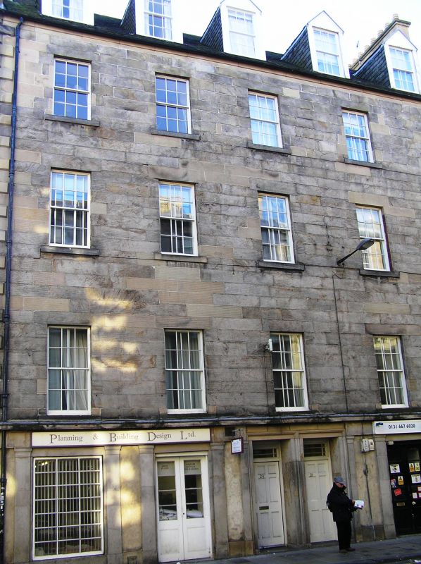
Entry Name: 24-30 West Nicolson Street, Edinburgh
Listing Name: Nicolson Street West, 24-30
Listing Date: 29 April 1977
Category: B
Source: Historic Scotland
Source ID: 369326
Historic Scotland Designation Reference: LB29439
Building Class: Cultural
ID on this website: 200369326
Location: Edinburgh
County: Edinburgh
Town: Edinburgh
Electoral Ward: Southside/Newington
Traditional County: Midlothian
Tagged with: Architectural structure
Later 18th century. 4-storey and attic 5-window tenement block,
droved ashlar with quoin ends, droved ground floor treatment
with anta order and paired central architraved doorpieces.
5 neat gabled timber dormers centred on windows below.
Slated roof. Original glazing throughout.
External links are from the relevant listing authority and, where applicable, Wikidata. Wikidata IDs may be related buildings as well as this specific building. If you want to add or update a link, you will need to do so by editing the Wikidata entry.


Other nearby listed buildings
