Approximate Location Map
Large Map »
Latitude: 57.6511 / 57°39'3"N
Longitude: -3.3041 / 3°18'14"W
OS Eastings: 322265
OS Northings: 863100
OS Grid: NJ222631
Mapcode National: GBR L86H.P4R
Mapcode Global: WH6J7.6YVH
Plus Code: 9C9RMM2W+C9
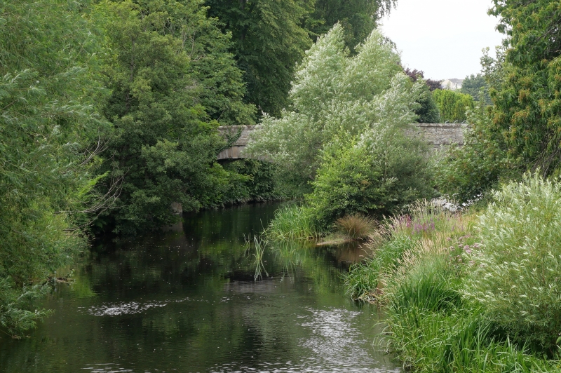
Entry Name: Brewery Bridge, River Lossie, Elgin
Listing Name: Brewery Bridge
Listing Date: 26 January 1971
Category: B
Source: Historic Scotland
Source ID: 371805
Historic Scotland Designation Reference: LB30700
Building Class: Cultural
Also known as: Brewery Bridge, Elgin
Elgin, River Lossie, Brewery Bridge
ID on this website: 200371805
Location: Elgin
County: Moray
Town: Elgin
Electoral Ward: Elgin City North
Traditional County: Morayshire
Tagged with: Bridge Road bridge Stone arch bridge
1798-1800. 2 segmental arched with oculi in central
spandrels. Coursed rubble with dressed stone to arch-rings,
band courses with coped parapet, splayed ends to cope.
Served the former road to Lossiemouth from Elgin.
Former Item 18 (1981 Revised List).
External links are from the relevant listing authority and, where applicable, Wikidata. Wikidata IDs may be related buildings as well as this specific building. If you want to add or update a link, you will need to do so by editing the Wikidata entry.


Other nearby listed buildings
