Approximate Location Map
Large Map »
Latitude: 56.1913 / 56°11'28"N
Longitude: -2.8164 / 2°48'59"W
OS Eastings: 349429
OS Northings: 700148
OS Grid: NO494001
Mapcode National: GBR 2Q.FWQQ
Mapcode Global: WH7SR.QN12
Plus Code: 9C8V55RM+GC
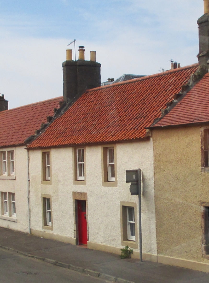
Entry Name: 7 High Street, Elie
Listing Name: 7 High Street
Listing Date: 18 August 1980
Category: B
Source: Historic Scotland
Source ID: 372116
Historic Scotland Designation Reference: LB30942
Building Class: Cultural
ID on this website: 200372116
Location: Elie and Earlsferry
County: Fife
Town: Elie And Earlsferry
Electoral Ward: East Neuk and Landward
Traditional County: Fife
Tagged with: Architectural structure
Dated 1749. 2-storey 3-window whitewashed harl and pantile, crowstepped; door lintel has 3 defaced shields (butcher's utensils) and date.
B group with items 12-14.
External links are from the relevant listing authority and, where applicable, Wikidata. Wikidata IDs may be related buildings as well as this specific building. If you want to add or update a link, you will need to do so by editing the Wikidata entry.


Other nearby listed buildings
