Approximate Location Map
Large Map »
Latitude: 56.1909 / 56°11'27"N
Longitude: -2.8168 / 2°49'0"W
OS Eastings: 349404
OS Northings: 700103
OS Grid: NO494001
Mapcode National: GBR 2Q.FWN9
Mapcode Global: WH7SR.PNVD
Plus Code: 9C8V55RM+87
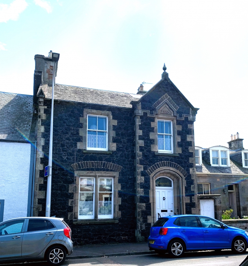
Entry Name: Kingscroft, 18 High Street, Elie
Listing Name: Elie Kingscroft 18 High Street
Listing Date: 8 January 1980
Category: C
Source: Historic Scotland
Source ID: 372139
Historic Scotland Designation Reference: LB30965
Building Class: Cultural
ID on this website: 200372139
Location: Elie and Earlsferry
County: Fife
Town: Elie And Earlsferry
Electoral Ward: East Neuk and Landward
Traditional County: Fife
Tagged with: Architectural structure
Style of John Currie, dated 1862. 2-storey 2-window whin rubble with stugged chamfered dressings, gabled entrance bay projection with moulded segment-headed doorpiece, slated.
External links are from the relevant listing authority and, where applicable, Wikidata. Wikidata IDs may be related buildings as well as this specific building. If you want to add or update a link, you will need to do so by editing the Wikidata entry.


Other nearby listed buildings
