Approximate Location Map
Large Map »
Latitude: 56.1898 / 56°11'23"N
Longitude: -2.8307 / 2°49'50"W
OS Eastings: 348539
OS Northings: 700001
OS Grid: NO485000
Mapcode National: GBR 2P.G5YM
Mapcode Global: WH7SR.HP75
Plus Code: 9C8V55Q9+WP
Entry Name: Pilgrim's Way, Liberty, Elie
Listing Name: Elie Pilgrim's Way, Liberty
Listing Date: 8 January 1980
Category: C
Source: Historic Scotland
Source ID: 372155
Historic Scotland Designation Reference: LB30978
Building Class: Cultural
ID on this website: 200372155
Location: Elie and Earlsferry
County: Fife
Town: Elie And Earlsferry
Electoral Ward: East Neuk and Landward
Traditional County: Fife
Tagged with: House
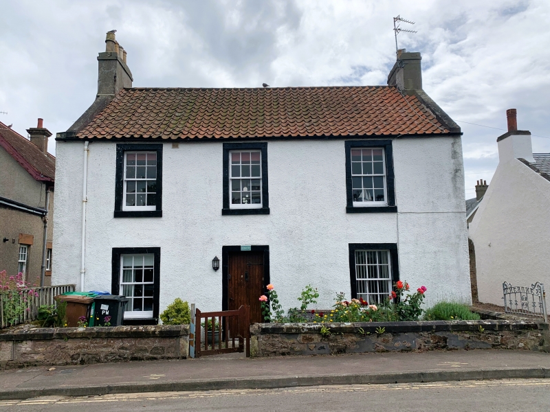
Late 18th century. 2-storey, harled with painted margins. 3-window front with central door. Original glazing. Pantiled roof with slate casing, skews and harled end stacks. Rendered flanks cutaway original south west corner and 2 storey 2 window flat roofed rear addition with matching sashes, one window original rear section at east end. Holes
cut in south east skew for access to roof. Dwarf rubble garden wall.
External links are from the relevant listing authority and, where applicable, Wikidata. Wikidata IDs may be related buildings as well as this specific building. If you want to add or update a link, you will need to do so by editing the Wikidata entry.


Other nearby listed buildings
