Approximate Location Map
Large Map »
Latitude: 56.1912 / 56°11'28"N
Longitude: -2.8214 / 2°49'17"W
OS Eastings: 349119
OS Northings: 700145
OS Grid: NO491001
Mapcode National: GBR 2Q.FVFQ
Mapcode Global: WH7SR.MNN3
Plus Code: 9C8V55RH+FC
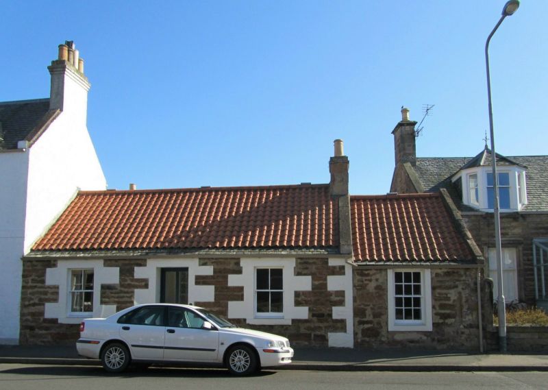
Entry Name: 6 Park Place, Elie
Listing Name: Elie 6 Park Place
Listing Date: 8 January 1980
Category: C
Source: Historic Scotland
Source ID: 372181
Historic Scotland Designation Reference: LB30995
Building Class: Cultural
ID on this website: 200372181
Location: Elie and Earlsferry
County: Fife
Town: Elie And Earlsferry
Electoral Ward: East Neuk and Landward
Traditional County: Fife
Tagged with: House
Earlier 19th century. Single-storey, roughly coursed rubble with large pointed droved ashlar dressings. Central door and 2 windows. Slightly lower 1-window wing to right (12-pane sash and case). Pantiled roof with stone slate casing, skews right of main block with ashlar stack end on right of wing.
External links are from the relevant listing authority and, where applicable, Wikidata. Wikidata IDs may be related buildings as well as this specific building. If you want to add or update a link, you will need to do so by editing the Wikidata entry.


Other nearby listed buildings
