Approximate Location Map
Large Map »
Latitude: 56.1915 / 56°11'29"N
Longitude: -2.8214 / 2°49'17"W
OS Eastings: 349120
OS Northings: 700175
OS Grid: NO491001
Mapcode National: GBR 2Q.FVFM
Mapcode Global: WH7SR.MMNX
Plus Code: 9C8V55RH+HC
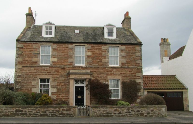
Entry Name: Baldionie, 10 Park Place, Elie
Listing Name: Elie Baldionie 10 Park Place
Listing Date: 8 January 1980
Category: B
Source: Historic Scotland
Source ID: 372183
Historic Scotland Designation Reference: LB30997
Building Class: Cultural
ID on this website: 200372183
Location: Elie and Earlsferry
County: Fife
Town: Elie And Earlsferry
Electoral Ward: East Neuk and Landward
Traditional County: Fife
Tagged with: House
Early 19th century. 2-storey and attic 3-window, coursed rubble with droved dressings, quoin angles, Roman doric pilastered doorpiece; gables harled; slated, 2 small piended dormers.
External links are from the relevant listing authority and, where applicable, Wikidata. Wikidata IDs may be related buildings as well as this specific building. If you want to add or update a link, you will need to do so by editing the Wikidata entry.


Other nearby listed buildings
