Approximate Location Map
Large Map »
Latitude: 56.19 / 56°11'23"N
Longitude: -2.8193 / 2°49'9"W
OS Eastings: 349248
OS Northings: 700006
OS Grid: NO492000
Mapcode National: GBR 2Q.FVZY
Mapcode Global: WH7SR.NPN2
Plus Code: 9C8V55QJ+X7
Entry Name: Wynd House, Rankeillor Street, Elie
Listing Name: Elie Wynd House, Rankeillor Street
Listing Date: 18 August 1972
Category: B
Source: Historic Scotland
Source ID: 372192
Historic Scotland Designation Reference: LB31006
Building Class: Cultural
ID on this website: 200372192
Location: Elie and Earlsferry
County: Fife
Town: Elie And Earlsferry
Electoral Ward: East Neuk and Landward
Traditional County: Fife
Tagged with: House
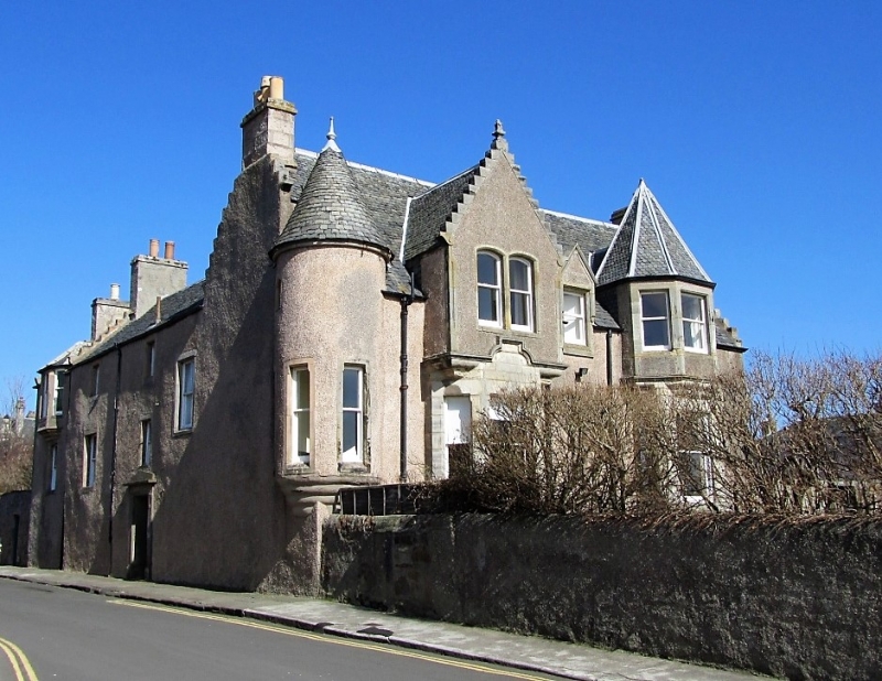
17th century. L-plan with corbelled angle turret, harl and slate, crowstepped; much altered, Victorian baronial south front with 2 bay windows.
For group with items in High Street.
External links are from the relevant listing authority and, where applicable, Wikidata. Wikidata IDs may be related buildings as well as this specific building. If you want to add or update a link, you will need to do so by editing the Wikidata entry.


Other nearby listed buildings
