Approximate Location Map
Large Map »
Latitude: 56.1898 / 56°11'23"N
Longitude: -2.8223 / 2°49'20"W
OS Eastings: 349066
OS Northings: 699986
OS Grid: NT490999
Mapcode National: GBR 2Q.G1WG
Mapcode Global: WH7SR.MP86
Plus Code: 9C8V55QH+W3
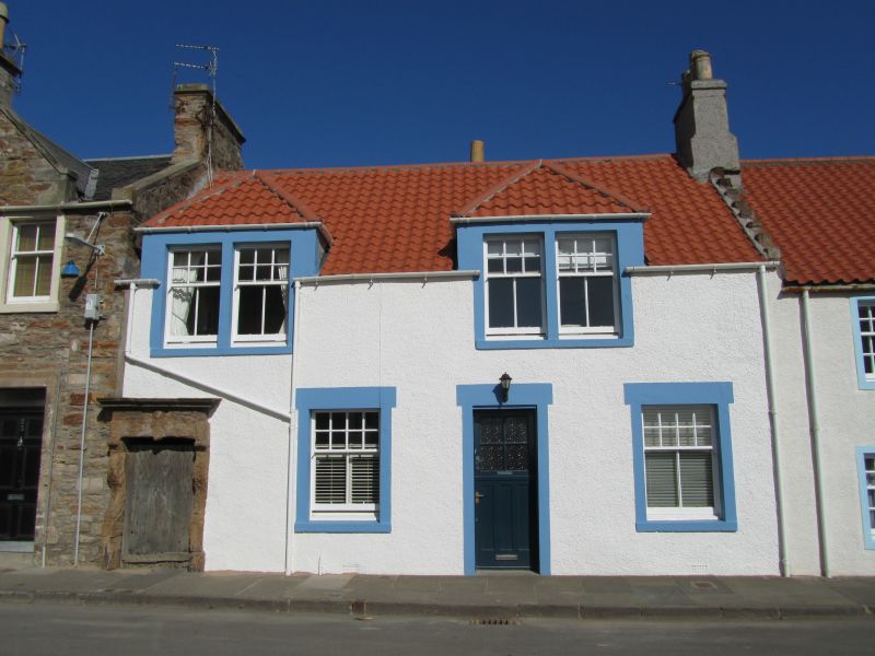
Entry Name: 19 South Street, Elie
Listing Name: Elie 19 South Street
Listing Date: 18 August 1972
Category: B
Source: Historic Scotland
Source ID: 372204
Historic Scotland Designation Reference: LB31018
Building Class: Cultural
ID on this website: 200372204
Location: Elie and Earlsferry
County: Fife
Town: Elie And Earlsferry
Electoral Ward: East Neuk and Landward
Traditional County: Fife
Tagged with: Architectural structure
Circa 1860, but modernised since, 2-storey, column washed harl with margins, piended dormerheads, pantiled and crowstepped; of interest chiefly for doorway remaining from "Muckle Yett", much weathered, console pilasters, keyblocked lintel, probably 1682.
External links are from the relevant listing authority and, where applicable, Wikidata. Wikidata IDs may be related buildings as well as this specific building. If you want to add or update a link, you will need to do so by editing the Wikidata entry.


Other nearby listed buildings
