Approximate Location Map
Large Map »
Latitude: 56.1897 / 56°11'22"N
Longitude: -2.8333 / 2°50'0"W
OS Eastings: 348378
OS Northings: 699983
OS Grid: NT483999
Mapcode National: GBR 2P.G5D4
Mapcode Global: WH7SR.GP09
Plus Code: 9C8V55Q8+VM
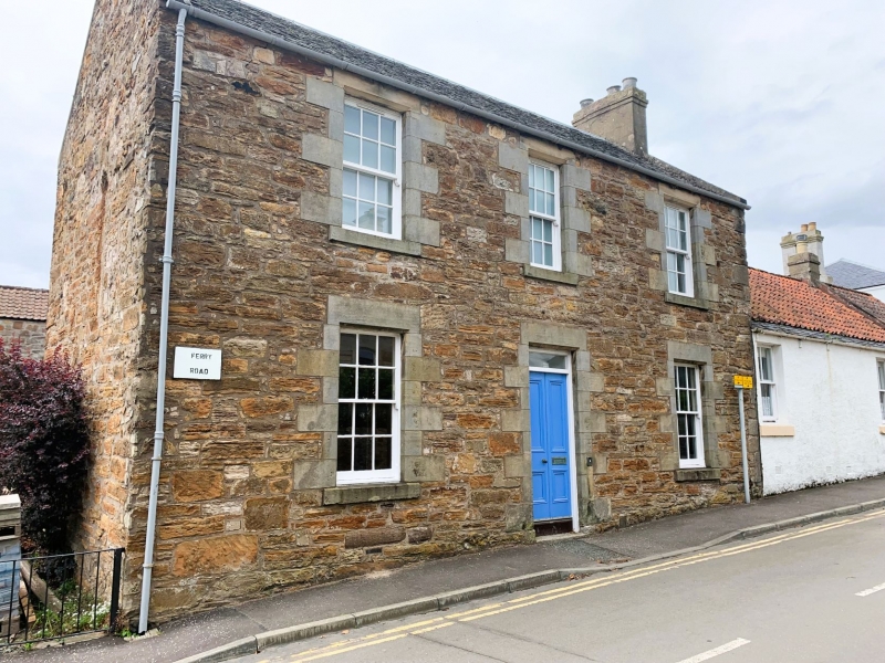
Entry Name: Ferry Lodge, Ferry Road, Earlsferry
Listing Name: Earlsferry Ferry Lodge, Ferry Road Corner off High Street
Listing Date: 8 January 1980
Category: C
Source: Historic Scotland
Source ID: 372241
Historic Scotland Designation Reference: LB31050
Building Class: Cultural
ID on this website: 200372241
Location: Elie and Earlsferry
County: Fife
Town: Elie And Earlsferry
Electoral Ward: East Neuk and Landward
Traditional County: Fife
Tagged with: Architectural structure
Earlier 19th century, plain Georgian. 2-storey, rubble with polished ashlar dressings chamfers perhaps later. 3-window front with central panelled door, 12-pane glazing. Slated roof. Straight skews and rendered brick end stacks. 3 window harled rear with single-storey porch in centre and addition to north.
Adjoining.
External links are from the relevant listing authority and, where applicable, Wikidata. Wikidata IDs may be related buildings as well as this specific building. If you want to add or update a link, you will need to do so by editing the Wikidata entry.


Other nearby listed buildings
