Approximate Location Map
Large Map »
Latitude: 56.1895 / 56°11'22"N
Longitude: -2.8332 / 2°49'59"W
OS Eastings: 348389
OS Northings: 699963
OS Grid: NT483999
Mapcode National: GBR 2P.G5F9
Mapcode Global: WH7SR.GP3F
Plus Code: 9C8V55Q8+QP
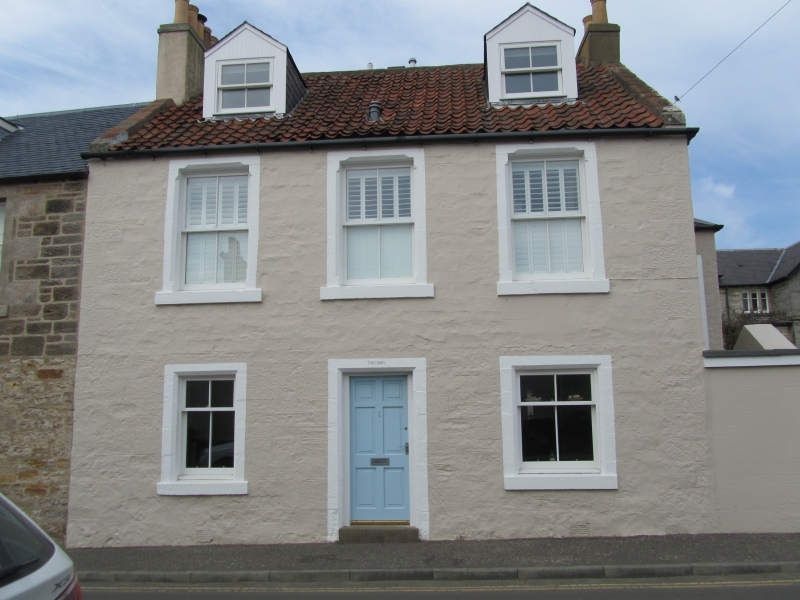
Entry Name: Earls Lodge, 1 High Street, Earlsferry
Listing Name: Earlsferry, 1 High Street, Earls Lodge
Listing Date: 18 August 1972
Category: C
Source: Historic Scotland
Source ID: 372243
Historic Scotland Designation Reference: LB31052
Building Class: Cultural
ID on this website: 200372243
Location: Elie and Earlsferry
County: Fife
Town: Elie And Earlsferry
Electoral Ward: East Neuk and Landward
Traditional County: Fife
Tagged with: Architectural structure
Probably late 18th century, altered. Single-storey,
2-window and centre door, stuccoed with lining out and
raised quoins; pantiled.
External links are from the relevant listing authority and, where applicable, Wikidata. Wikidata IDs may be related buildings as well as this specific building. If you want to add or update a link, you will need to do so by editing the Wikidata entry.


Other nearby listed buildings
