Approximate Location Map
Large Map »
Latitude: 55.9991 / 55°59'56"N
Longitude: -3.7844 / 3°47'3"W
OS Eastings: 288812
OS Northings: 679902
OS Grid: NS888799
Mapcode National: GBR 1K.V1SC
Mapcode Global: WH5QZ.VG3V
Plus Code: 9C7RX6X8+M7
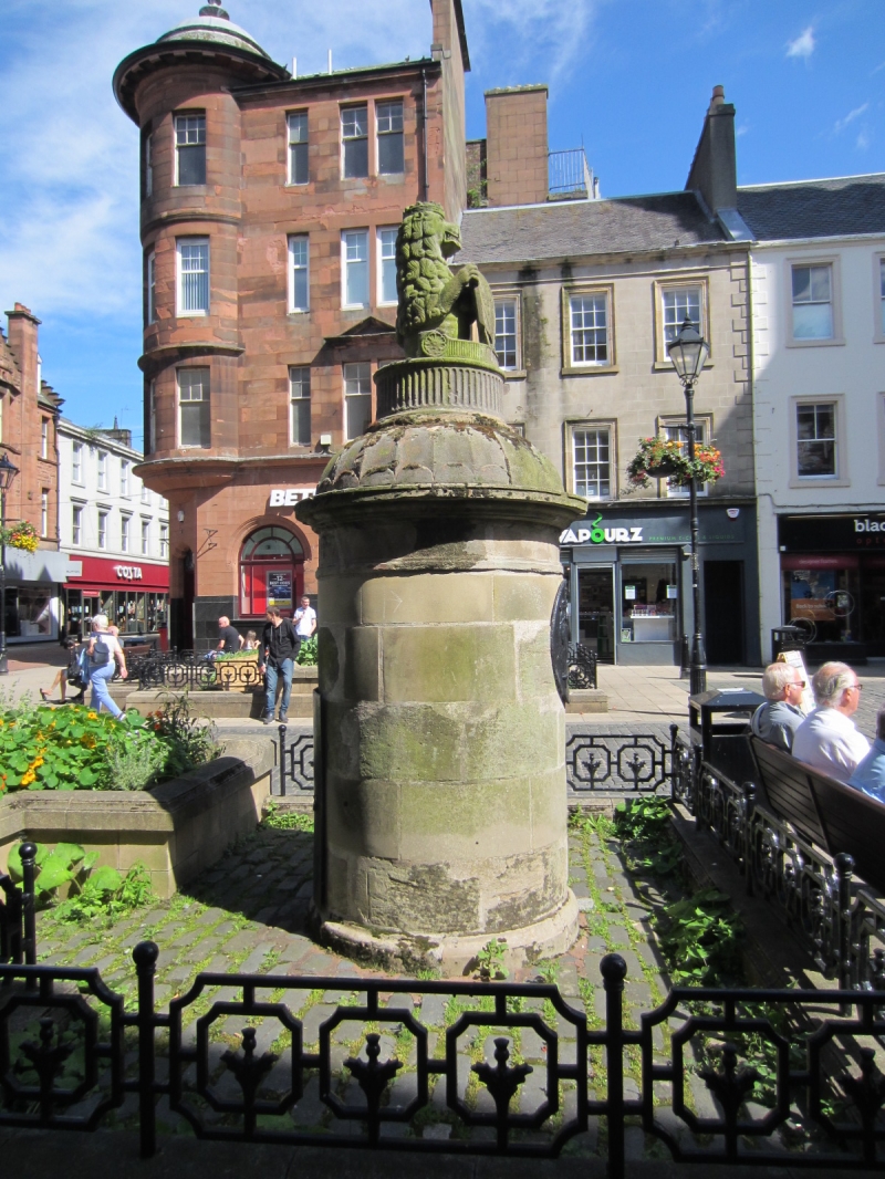
Entry Name: Cross Well, High Street, Falkirk
Listing Name: Cross Well. High Street
Listing Date: 21 March 1960
Category: B
Source: Historic Scotland
Source ID: 372386
Historic Scotland Designation Reference: LB31177
Building Class: Cultural
ID on this website: 200372386
Location: Falkirk
County: Falkirk
Town: Falkirk
Electoral Ward: Falkirk South
Traditional County: Stirlingshire
Tagged with: Architectural structure
Dated 1817. Circular ashlar structure fluted dome bearing
fluted drum surmounted by lion with shield; fine figured
cast-iron oval panel at former pump.
De-scheduled 8 November 1999.
External links are from the relevant listing authority and, where applicable, Wikidata. Wikidata IDs may be related buildings as well as this specific building. If you want to add or update a link, you will need to do so by editing the Wikidata entry.


Other nearby listed buildings
