Approximate Location Map
Large Map »
Latitude: 55.9992 / 55°59'57"N
Longitude: -3.7836 / 3°47'0"W
OS Eastings: 288861
OS Northings: 679905
OS Grid: NS888799
Mapcode National: GBR 1K.V1YV
Mapcode Global: WH5QZ.VGGT
Plus Code: 9C7RX6X8+MH
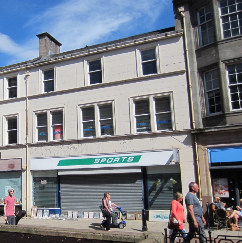
Entry Name: 130 High Street, Falkirk
Listing Name: 130 High Street
Listing Date: 25 October 1972
Category: C
Source: Historic Scotland
Source ID: 372390
Historic Scotland Designation Reference: LB31181
Building Class: Cultural
ID on this website: 200372390
Location: Falkirk
County: Falkirk
Town: Falkirk
Electoral Ward: Falkirk South
Traditional County: Stirlingshire
Tagged with: Architectural structure
Mid 19th century, much altered. 3-storey painted quoined
ashlar, 2 bipartite window alteration 1st floor, single
modern window 2nd floor, ground floor shop.
Group value only as altered.
Re-categorised as C(S) from B for Group. The listing relates specifically to the group intetest of the subject. It applies, as always, to interior as well as exterior, as appropriate to building type.
External links are from the relevant listing authority and, where applicable, Wikidata. Wikidata IDs may be related buildings as well as this specific building. If you want to add or update a link, you will need to do so by editing the Wikidata entry.


Other nearby listed buildings
