Approximate Location Map
Large Map »
Latitude: 55.9988 / 55°59'55"N
Longitude: -3.7831 / 3°46'59"W
OS Eastings: 288887
OS Northings: 679862
OS Grid: NS888798
Mapcode National: GBR 1K.V21G
Mapcode Global: WH5QZ.VHP3
Plus Code: 9C7RX6X8+GP
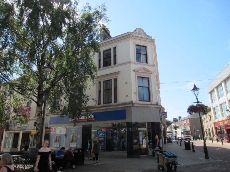
Entry Name: 147-149 High Street, Falkirk
Listing Name: 147, 149 High Street, 2 Cow Wynd
Listing Date: 25 October 1972
Category: B
Source: Historic Scotland
Source ID: 372407
Historic Scotland Designation Reference: LB31192
Building Class: Cultural
ID on this website: 200372407
Location: Falkirk
County: Falkirk
Town: Falkirk
Electoral Ward: Falkirk South
Traditional County: Stirlingshire
Tagged with: Tenement
William Stirling III (William Stirling and Son) 1862 as
Learmonth's Buildings. Late classical, 3-storey 6-window to
Cow Wynd 3-window to High Street, 1-window splayed angle,
architraved openings with cornice and pediments 1st floor,
parapet and slated roof; modern ground floor office.
External links are from the relevant listing authority and, where applicable, Wikidata. Wikidata IDs may be related buildings as well as this specific building. If you want to add or update a link, you will need to do so by editing the Wikidata entry.


Other nearby listed buildings
