Approximate Location Map
Large Map »
Latitude: 55.9977 / 55°59'51"N
Longitude: -3.7828 / 3°46'58"W
OS Eastings: 288903
OS Northings: 679742
OS Grid: NS889797
Mapcode National: GBR 1K.V241
Mapcode Global: WH5QZ.VHTX
Plus Code: 9C7RX6X8+3V
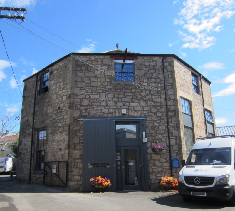
Entry Name: The Tattie Kirk, Cow Wynd, Falkirk
Listing Name: Cow Wynd Tattie Kirk
Listing Date: 25 October 1972
Category: B
Source: Historic Scotland
Source ID: 372440
Historic Scotland Designation Reference: LB31216
Building Class: Cultural
ID on this website: 200372440
Location: Falkirk
County: Falkirk
Town: Falkirk
Electoral Ward: Falkirk South
Traditional County: Stirlingshire
Tagged with: Church building
1804. Octagonal plan; rubble-built with ashlar quoins and
margins. Entrances on north side to ground floor and gallery,
the latter with external stair, additional (blocked) door at
south east. Windows, multi-paned to ground and gallery. Slate
roof with urn finial.
Interior much altered (now used as warehouses)
Built for an Anti-Burgher congregation
External links are from the relevant listing authority and, where applicable, Wikidata. Wikidata IDs may be related buildings as well as this specific building. If you want to add or update a link, you will need to do so by editing the Wikidata entry.


Other nearby listed buildings
