Approximate Location Map
Large Map »
Latitude: 55.998 / 55°59'52"N
Longitude: -3.7842 / 3°47'3"W
OS Eastings: 288818
OS Northings: 679774
OS Grid: NS888797
Mapcode National: GBR 1K.V1TW
Mapcode Global: WH5QZ.VH5Q
Plus Code: 9C7RX6X8+58
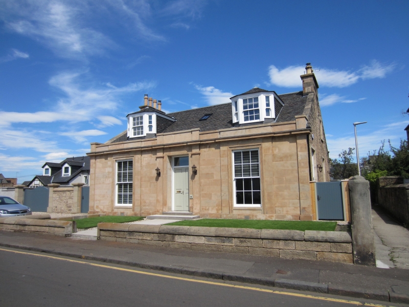
Entry Name: 7 Booth Place, Falkirk
Listing Name: 7 Booth Place
Listing Date: 23 April 1979
Category: C
Source: Historic Scotland
Source ID: 372442
Historic Scotland Designation Reference: LB31218
Building Class: Cultural
ID on this website: 200372442
Location: Falkirk
County: Falkirk
Town: Falkirk
Electoral Ward: Falkirk South
Traditional County: Stirlingshire
Tagged with: Architectural structure
Similar to above but with attic (canted dormers) and no
rear addition.
External links are from the relevant listing authority and, where applicable, Wikidata. Wikidata IDs may be related buildings as well as this specific building. If you want to add or update a link, you will need to do so by editing the Wikidata entry.


Other nearby listed buildings
