Approximate Location Map
Large Map »
Latitude: 56.2533 / 56°15'12"N
Longitude: -3.2081 / 3°12'29"W
OS Eastings: 325242
OS Northings: 707414
OS Grid: NO252074
Mapcode National: GBR 27.9Z3V
Mapcode Global: WH6R7.P2JY
Plus Code: 9C8R7Q3R+8P
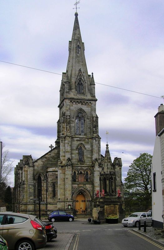
Entry Name: Falkland Parish Church, High Street, Falkland
Listing Name: Falkland Parish Church High Street
Listing Date: 1 December 1971
Category: B
Source: Historic Scotland
Source ID: 372480
Historic Scotland Designation Reference: LB31254
Building Class: Cultural
ID on this website: 200372480
Location: Falkland
County: Fife
Town: Falkland
Electoral Ward: Howe of Fife and Tay Coast
Traditional County: Fife
Tagged with: Church building
David Bryce 1849. Early pointed, 4-bay rectangle with 5 bell
tower, lucarned and pinnacled broach spire: stugged ashlar,
slated.
Ecclesiastical building in use as such.
External links are from the relevant listing authority and, where applicable, Wikidata. Wikidata IDs may be related buildings as well as this specific building. If you want to add or update a link, you will need to do so by editing the Wikidata entry.


Other nearby listed buildings
