Approximate Location Map
Large Map »
Latitude: 56.253 / 56°15'10"N
Longitude: -3.2087 / 3°12'31"W
OS Eastings: 325205
OS Northings: 707377
OS Grid: NO252073
Mapcode National: GBR 27.B528
Mapcode Global: WH6R7.P376
Plus Code: 9C8R7Q3R+5G
Entry Name: Stag Inn, High Street, Falkland
Listing Name: Stag Inn, High Street and Mill Wynd
Listing Date: 1 December 1971
Category: B
Source: Historic Scotland
Source ID: 372488
Historic Scotland Designation Reference: LB31262
Building Class: Cultural
ID on this website: 200372488
Location: Falkland
County: Fife
Town: Falkland
Electoral Ward: Howe of Fife and Tay Coast
Traditional County: Fife
Tagged with: Inn
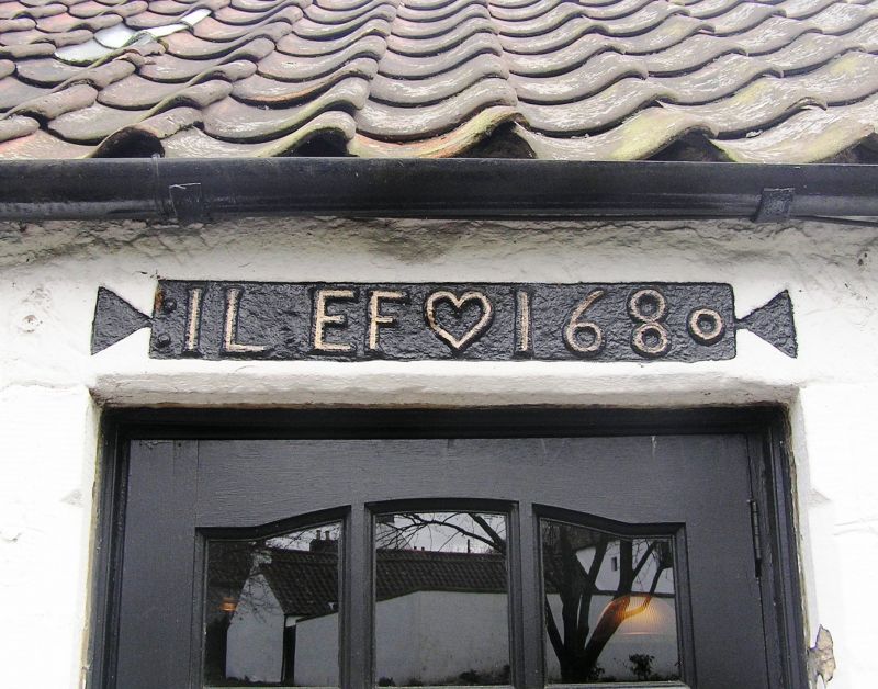
Dated Il.EF 1680 at lintel of wing, front building probably
of same period 2-storey 3-window painted stucco with painted
margins, pantiled; harled and crowstepped gable to Wynd;
much altered single-storey wing to north, rubble and pantile
with piended roof.
External links are from the relevant listing authority and, where applicable, Wikidata. Wikidata IDs may be related buildings as well as this specific building. If you want to add or update a link, you will need to do so by editing the Wikidata entry.


Other nearby listed buildings
