Approximate Location Map
Large Map »
Latitude: 56.6438 / 56°38'37"N
Longitude: -2.8895 / 2°53'22"W
OS Eastings: 345549
OS Northings: 750569
OS Grid: NO455505
Mapcode National: GBR VM.4JSN
Mapcode Global: WH7QL.L88N
Plus Code: 9C8VJ4V6+G6
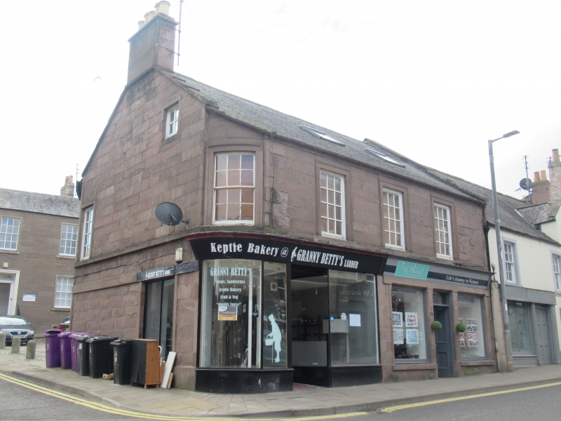
Entry Name: 11-13 West High Street, Forfar
Listing Name: 11, 13 West High Street and 27 Little Causeway
Listing Date: 11 June 1971
Category: B
Source: Historic Scotland
Source ID: 372776
Historic Scotland Designation Reference: LB31508
Building Class: Cultural
ID on this website: 200372776
Location: Forfar
County: Angus
Town: Forfar
Electoral Ward: Forfar and District
Traditional County: Angus
Tagged with: Architectural structure
Early 19th century. 2-storey 3-window, ground floor partly
modernised, ashlar 1st floor with architraves, 1-window
quadrant corner to West High Street; rear elevation to Little
Causeway coursed rubble, irregular fenestration.
External links are from the relevant listing authority and, where applicable, Wikidata. Wikidata IDs may be related buildings as well as this specific building. If you want to add or update a link, you will need to do so by editing the Wikidata entry.


Other nearby listed buildings
