Approximate Location Map
Large Map »
Latitude: 56.6501 / 56°39'0"N
Longitude: -2.8955 / 2°53'43"W
OS Eastings: 345187
OS Northings: 751285
OS Grid: NO451512
Mapcode National: GBR VM.43DJ
Mapcode Global: WH7QL.H3DR
Plus Code: 9C8VM423+3Q
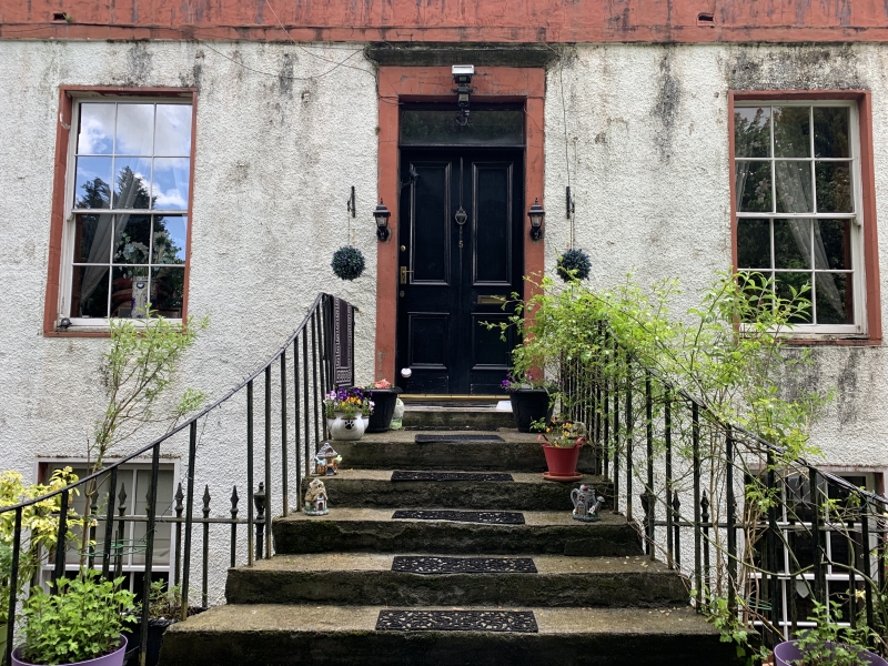
Entry Name: Bankhead House, Forfar
Listing Name: Bankhead House
Listing Date: 11 June 1971
Category: B
Source: Historic Scotland
Source ID: 372899
Historic Scotland Designation Reference: LB31611
Building Class: Cultural
ID on this website: 200372899
Location: Forfar
County: Angus
Town: Forfar
Electoral Ward: Forfar and District
Traditional County: Angus
Tagged with: House
Original part 2-storey 18th century, harled with ashlar
chimneys, back wing, stone slates; single storey and basement
4-window and centre door front with ashlar parapet and railed
steps added early 19th century: some alterations recently.
External links are from the relevant listing authority and, where applicable, Wikidata. Wikidata IDs may be related buildings as well as this specific building. If you want to add or update a link, you will need to do so by editing the Wikidata entry.


Other nearby listed buildings
