Approximate Location Map
Large Map »
Latitude: 57.6093 / 57°36'33"N
Longitude: -3.6135 / 3°36'48"W
OS Eastings: 303689
OS Northings: 858845
OS Grid: NJ036588
Mapcode National: GBR K8FM.5FK
Mapcode Global: WH5HB.G0HG
Plus Code: 9C9RJ95P+PH
Entry Name: 6 Cumming Street, Forres
Listing Name: 6 Cumming Street
Listing Date: 30 March 1983
Category: B
Source: Historic Scotland
Source ID: 372925
Historic Scotland Designation Reference: LB31634
Building Class: Cultural
ID on this website: 200372925
Location: Forres
County: Moray
Town: Forres
Electoral Ward: Forres
Traditional County: Morayshire
Tagged with: House
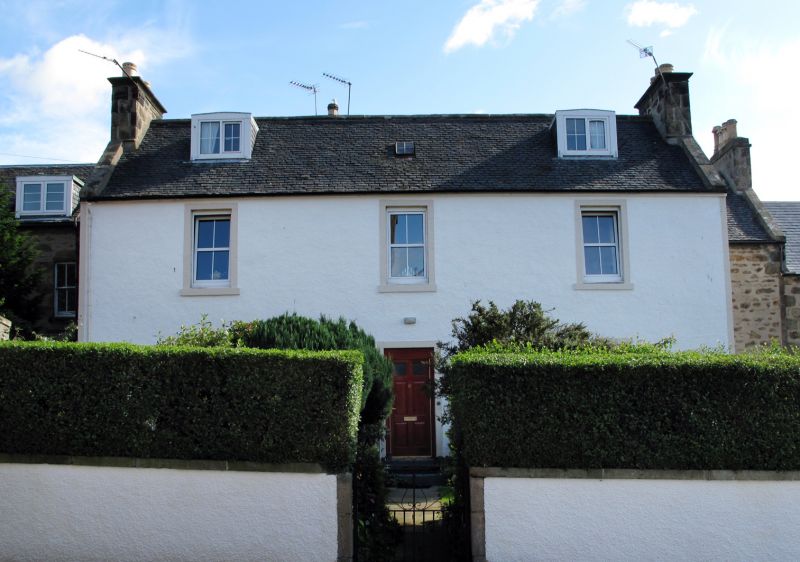
Later 18th century. 2-storey and attic (with basement), 3-bay
with centre door. Harled, painted margins. extra inserted
window ground floor; 12-pane sashes; 2 modern segmental-
headed dormers. Panelled end stacks with later flared caps;
West Highlands slate roof.
Appears on Wood's map adjoined to other houses; evidence
remains on N gable.
Former Item 19 (1983 Revised List)
External links are from the relevant listing authority and, where applicable, Wikidata. Wikidata IDs may be related buildings as well as this specific building. If you want to add or update a link, you will need to do so by editing the Wikidata entry.


Other nearby listed buildings
