Approximate Location Map
Large Map »
Latitude: 57.6094 / 57°36'33"N
Longitude: -3.6141 / 3°36'50"W
OS Eastings: 303654
OS Northings: 858856
OS Grid: NJ036588
Mapcode National: GBR K8FM.55T
Mapcode Global: WH5H4.GZ6Y
Plus Code: 9C9RJ95P+Q8
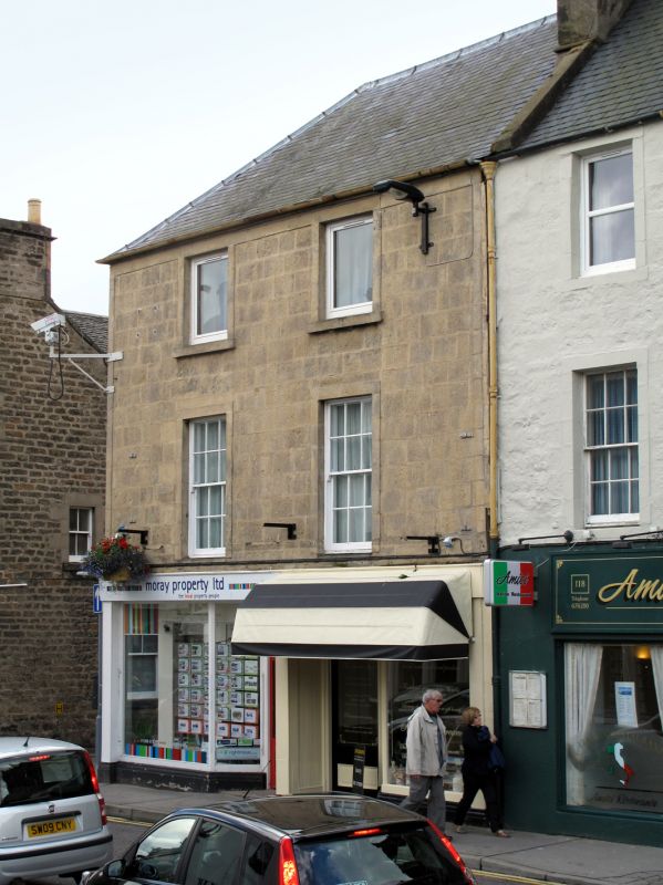
Entry Name: 114, 116 High Street, Forres
Listing Name: 114, 116 High Street and 1A Cumming Street
Listing Date: 26 January 1971
Category: C
Source: Historic Scotland
Source ID: 373017
Historic Scotland Designation Reference: LB31707
Building Class: Cultural
ID on this website: 200373017
Location: Forres
County: Moray
Town: Forres
Electoral Ward: Forres
Traditional County: Morayshire
Tagged with: Architectural structure
Circa 1800. 3-storey, 2-bay. Tooled ashlar with tooled ashlar
margins and angle strips. Later shopfront at ground floor;
2nd floor lintel/eaves course. 12-pane sashes to High Street.
Slate roof, piended at corner to Cumming Street.
No 114 corner site with Cumming Street.
Former Item 92 (1983 Revised List)
External links are from the relevant listing authority and, where applicable, Wikidata. Wikidata IDs may be related buildings as well as this specific building. If you want to add or update a link, you will need to do so by editing the Wikidata entry.


Other nearby listed buildings
