Approximate Location Map
Large Map »
Latitude: 57.6102 / 57°36'36"N
Longitude: -3.6104 / 3°36'37"W
OS Eastings: 303880
OS Northings: 858939
OS Grid: NJ038589
Mapcode National: GBR K8GL.T2J
Mapcode Global: WH5H4.HZZB
Plus Code: 9C9RJ96Q+3R
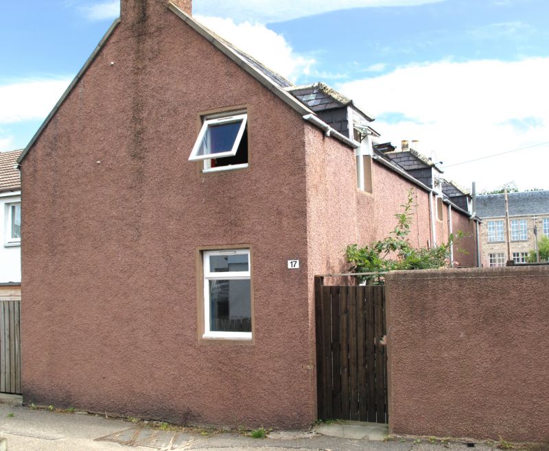
Entry Name: 17 Urquhart Street, Forres
Listing Name: 17 Urquhart Street
Listing Date: 30 March 1983
Category: C
Source: Historic Scotland
Source ID: 373079
Historic Scotland Designation Reference: LB31756
Building Class: Cultural
ID on this website: 200373079
Location: Forres
County: Moray
Town: Forres
Electoral Ward: Forres
Traditional County: Morayshire
Tagged with: House
Early 19th century. 2-storey house with 2 raised dormerheads;
3 bays with centre door; gable end to street. Rubble, tooled
ashlar dressings; West Highland slate roof.
Former Item 144 (1983 Revised List)
External links are from the relevant listing authority and, where applicable, Wikidata. Wikidata IDs may be related buildings as well as this specific building. If you want to add or update a link, you will need to do so by editing the Wikidata entry.


Other nearby listed buildings
