Approximate Location Map
Large Map »
Latitude: 57.61 / 57°36'35"N
Longitude: -3.6104 / 3°36'37"W
OS Eastings: 303881
OS Northings: 858920
OS Grid: NJ038589
Mapcode National: GBR K8GM.0WG
Mapcode Global: WH5H4.JZ0H
Plus Code: 9C9RJ96Q+2V
Entry Name: 20A Urquhart Street, Forres
Listing Name: 20A Urquhart Street
Listing Date: 30 March 1983
Category: C
Source: Historic Scotland
Source ID: 373084
Historic Scotland Designation Reference: LB31761
Building Class: Cultural
ID on this website: 200373084
Location: Forres
County: Moray
Town: Forres
Electoral Ward: Forres
Traditional County: Morayshire
Tagged with: House
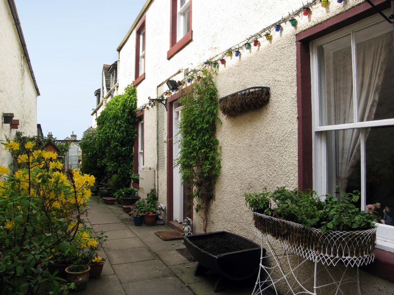
Earlier 19th century, 2 storeys, 3 bays with centre door.
Harled frontage, painted margins; rubble gable end to street
and to rear. 4-pane glazing. Band course to street; panelled
end stacks; slate roof.
20A and 20B adjoin one another.
Former Item 147 (1983 Revised List)
External links are from the relevant listing authority and, where applicable, Wikidata. Wikidata IDs may be related buildings as well as this specific building. If you want to add or update a link, you will need to do so by editing the Wikidata entry.


Other nearby listed buildings
