Approximate Location Map
Large Map »
Latitude: 57.613 / 57°36'46"N
Longitude: -3.6059 / 3°36'21"W
OS Eastings: 304155
OS Northings: 859243
OS Grid: NJ041592
Mapcode National: GBR K8GL.NYK
Mapcode Global: WH5H4.LX36
Plus Code: 9C9RJ97V+5J
Entry Name: Roseville, Victoria Road, Forres
Listing Name: Victoria Road, Roseville
Listing Date: 30 March 1983
Category: B
Source: Historic Scotland
Source ID: 373094
Historic Scotland Designation Reference: LB31771
Building Class: Cultural
ID on this website: 200373094
Location: Forres
County: Moray
Town: Forres
Electoral Ward: Forres
Traditional County: Morayshire
Tagged with: House
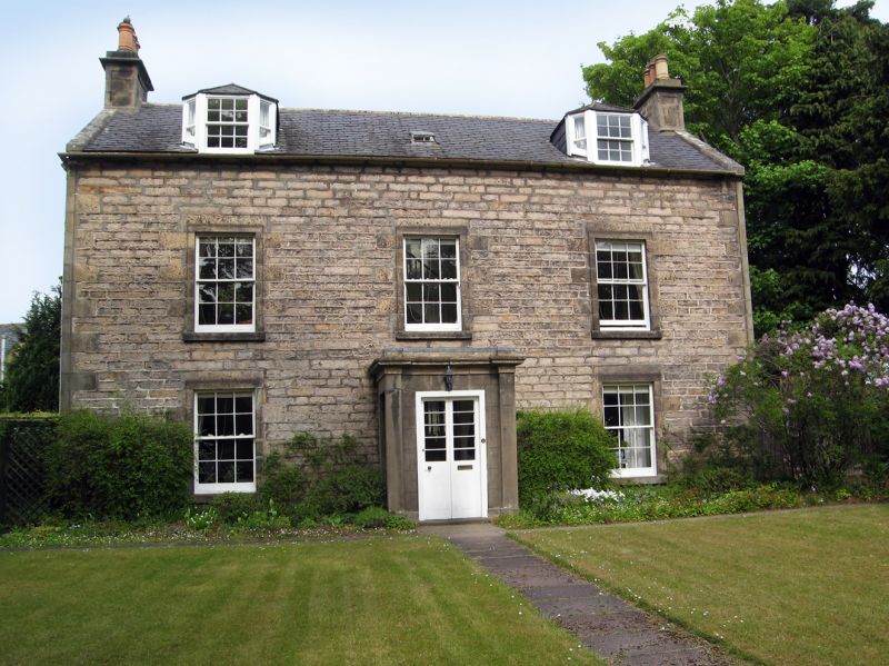
Early 19th century. 2 storeys and attic, 3 bays with centre
door. Coursed stugged rubble; rubble to gables and rear.
Raised ashlar angle and window margins; later 19th century
square porch with windows and lying pane glazing. 12-pane
sashes; 2 piended canted dormers; moulded eaves cornice. End
stacks; slate roof. Low coped garden wall to street with end
piers.
Former Item 156 (1983 Revised List)
External links are from the relevant listing authority and, where applicable, Wikidata. Wikidata IDs may be related buildings as well as this specific building. If you want to add or update a link, you will need to do so by editing the Wikidata entry.


Other nearby listed buildings
