Approximate Location Map
Large Map »
Latitude: 57.5923 / 57°35'32"N
Longitude: -4.1159 / 4°6'57"W
OS Eastings: 273622
OS Northings: 857784
OS Grid: NH736577
Mapcode National: GBR J86N.HDF
Mapcode Global: WH4FY.RF8H
Plus Code: 9C9QHVRM+WM
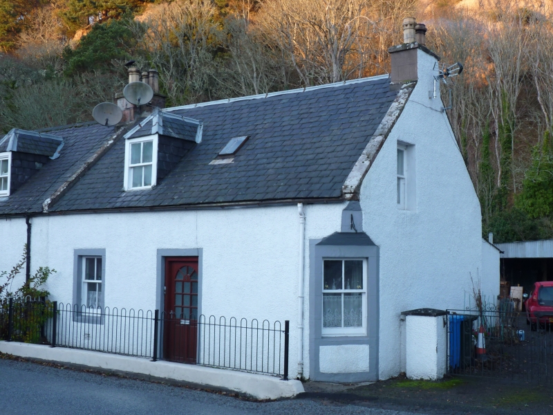
Entry Name: 4 Bridge Street, Rosemarkie
Listing Name: Rosemarkie 4 Bridge Street
Listing Date: 31 August 1983
Category: C
Source: Historic Scotland
Source ID: 373186
Historic Scotland Designation Reference: LB31842
Building Class: Cultural
ID on this website: 200373186
Location: Fortrose
County: Highland
Town: Fortrose
Electoral Ward: Black Isle
Traditional County: Ross-shire
Tagged with: Cottage
Mid/late 19th century single storey and attic, 3-bay cottage
with right bay canted. Harled with painted droved ashlar
margins. Piended dormer; slate roof. Paired with No 6 Bridge
Street.
External links are from the relevant listing authority and, where applicable, Wikidata. Wikidata IDs may be related buildings as well as this specific building. If you want to add or update a link, you will need to do so by editing the Wikidata entry.


Other nearby listed buildings
