Approximate Location Map
Large Map »
Latitude: 57.6917 / 57°41'30"N
Longitude: -2.0119 / 2°0'42"W
OS Eastings: 399389
OS Northings: 866876
OS Grid: NJ993668
Mapcode National: GBR P8DD.6ZC
Mapcode Global: WH9N2.2X7T
Plus Code: 9C9VMXRQ+M6
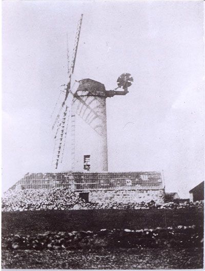
Entry Name: Windmill Stump, Fraserburgh
Listing Name: Windmill Tower Within Gray's Timber Yard Albert Street, Mid Street and Charlotte Street
Listing Date: 16 April 1971
Category: B
Source: Historic Scotland
Source ID: 373261
Historic Scotland Designation Reference: LB31908
Building Class: Cultural
ID on this website: 200373261
Location: Fraserburgh
County: Aberdeenshire
Town: Fraserburgh
Electoral Ward: Fraserburgh and District
Traditional County: Aberdeenshire
Tagged with: Windmill
18th and early 19th centuries. Rubble built with later top stage
and brick crenellated parapet.
External links are from the relevant listing authority and, where applicable, Wikidata. Wikidata IDs may be related buildings as well as this specific building. If you want to add or update a link, you will need to do so by editing the Wikidata entry.


Other nearby listed buildings
