Approximate Location Map
Large Map »
Latitude: 55.8343 / 55°50'3"N
Longitude: -4.2643 / 4°15'51"W
OS Eastings: 258285
OS Northings: 662432
OS Grid: NS582624
Mapcode National: GBR 0JX.NB
Mapcode Global: WH3P8.GMM7
Plus Code: 9C7QRPMP+M7
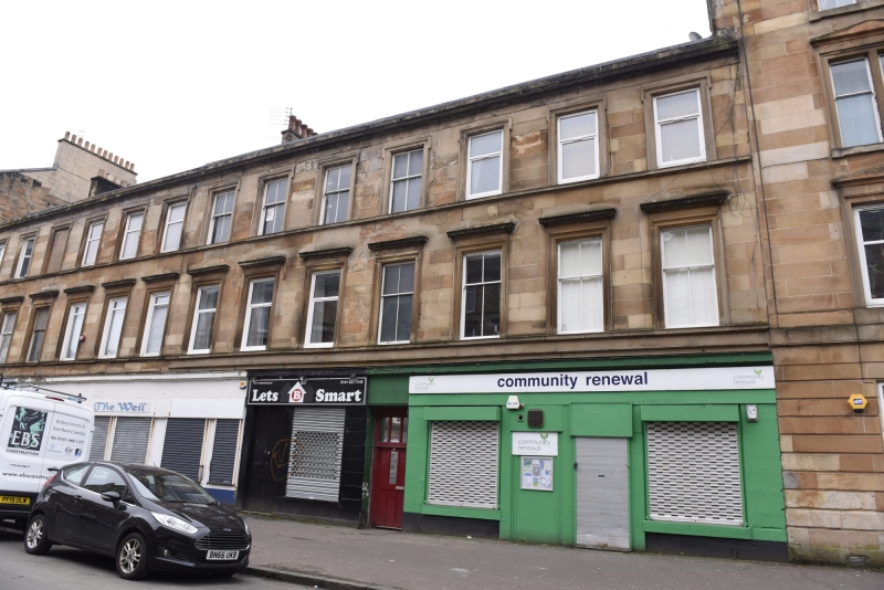
Entry Name: 32, 34, 36, 38, 40 Albert Road, Glasgow
Listing Name: 34-50 (Even Nos) Albert Road
Listing Date: 5 December 1989
Category: B
Source: Historic Scotland
Source ID: 374545
Historic Scotland Designation Reference: LB32417
Building Class: Cultural
ID on this website: 200374545
Location: Glasgow
County: Glasgow
Town: Glasgow
Electoral Ward: Southside Central
Traditional County: Renfrewshire
Tagged with: Building
Mid/later 19th century. Late Georgian-style 3-storey
tenement with shops at ground, single window bays
above, architraved windows, corniced at 1st floor,
strings at cill levels, some windows retain sashes with
4-pane glazing; window levels integrated with those of
tenements adjoining. Polished ashlar; stacks; slate
roof.
External links are from the relevant listing authority and, where applicable, Wikidata. Wikidata IDs may be related buildings as well as this specific building. If you want to add or update a link, you will need to do so by editing the Wikidata entry.


Other nearby listed buildings
