Approximate Location Map
Large Map »
Latitude: 55.8343 / 55°50'3"N
Longitude: -4.2652 / 4°15'54"W
OS Eastings: 258227
OS Northings: 662435
OS Grid: NS582624
Mapcode National: GBR 0JX.GB
Mapcode Global: WH3P8.GM57
Plus Code: 9C7QRPMM+PW
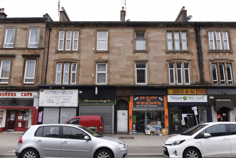
Entry Name: 519, 521, 523, 525, 527 Victoria Road, Glasgow
Listing Name: 519-537 (Odd Nos) Victoria Road
Listing Date: 5 December 1989
Category: C
Source: Historic Scotland
Source ID: 374672
Historic Scotland Designation Reference: LB32463
Building Class: Cultural
ID on this website: 200374672
Location: Glasgow
County: Glasgow
Town: Glasgow
Electoral Ward: Southside Central
Traditional County: Renfrewshire
Tagged with: Architectural structure
Later 19th century 3-storey tenement with shops at
ground, stone-cleaned ashlar above, architraved
openings, 3-light and single-light windows, some
original sashes. Cornice; rebuilt stacks; modern tile
roof.
External links are from the relevant listing authority and, where applicable, Wikidata. Wikidata IDs may be related buildings as well as this specific building. If you want to add or update a link, you will need to do so by editing the Wikidata entry.


Other nearby listed buildings
