Approximate Location Map
Large Map »
Latitude: 55.8609 / 55°51'39"N
Longitude: -4.2324 / 4°13'56"W
OS Eastings: 260376
OS Northings: 665327
OS Grid: NS603653
Mapcode National: GBR 0RL.3S
Mapcode Global: WH3P2.YYQC
Plus Code: 9C7QVQ69+82
Entry Name: Lady Well, Ladywell Street, Glasgow
Listing Name: Ladywell Street, Lady Well
Listing Date: 15 December 1970
Category: B
Source: Historic Scotland
Source ID: 378040
Historic Scotland Designation Reference: LB33902
Building Class: Cultural
ID on this website: 200378040
Location: Glasgow
County: Glasgow
Town: Glasgow
Electoral Ward: Dennistoun
Traditional County: Lanarkshire
Tagged with: Architectural structure
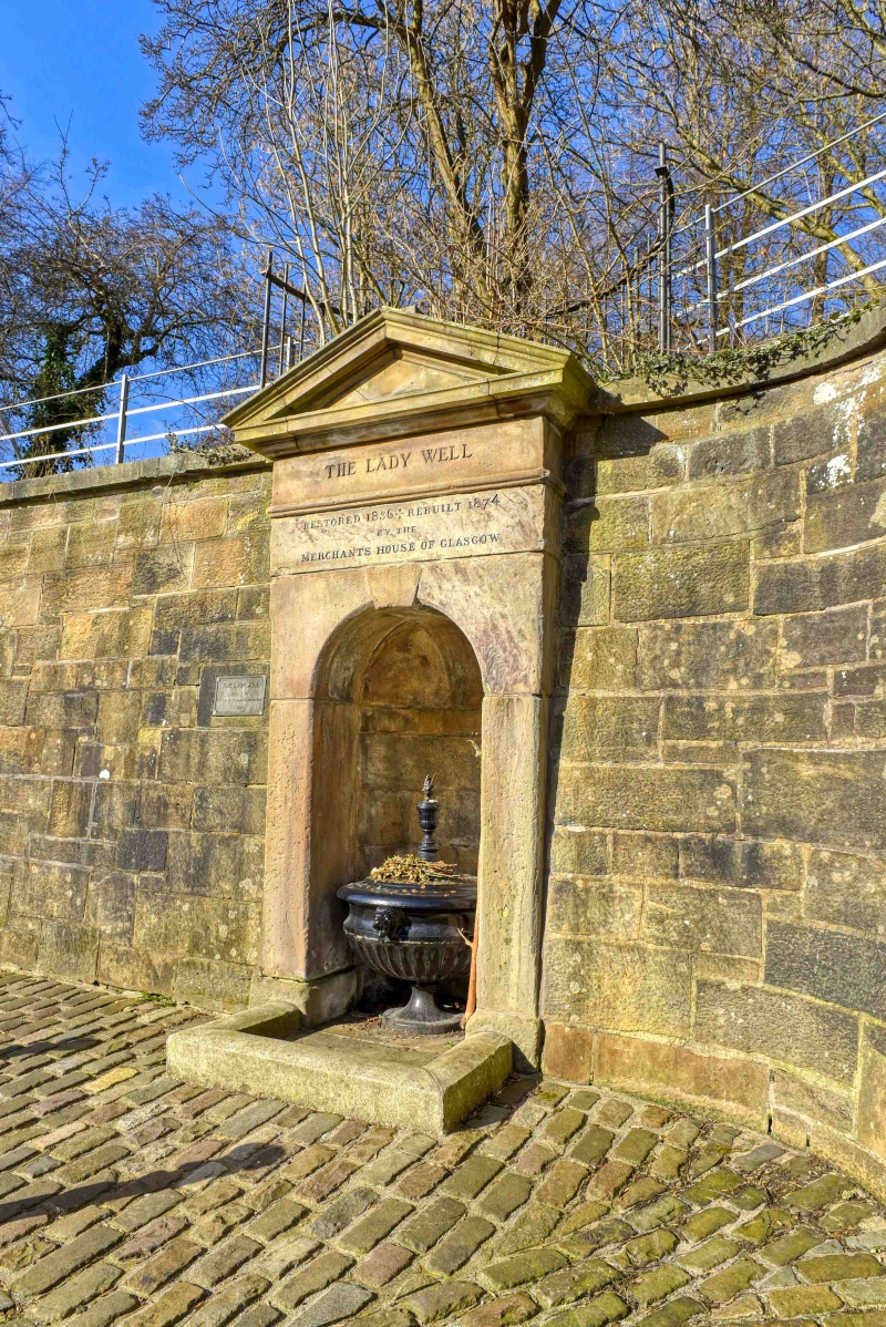
Inscribed "Restored 1836. Rebuilt 1874 by the Merchants House of Glasgow". Holy well used since early times, now incorporated within Necropolis boundary wall; set in alcoved niche with deep frieze, cross finialled pediment. Ashlar. PLaque alonside refers to further restoration by Tennent Caledonian Breweries, 1983.
External links are from the relevant listing authority and, where applicable, Wikidata. Wikidata IDs may be related buildings as well as this specific building. If you want to add or update a link, you will need to do so by editing the Wikidata entry.


Other nearby listed buildings
