Approximate Location Map
Large Map »
Latitude: 55.8606 / 55°51'38"N
Longitude: -4.224 / 4°13'26"W
OS Eastings: 260900
OS Northings: 665285
OS Grid: NS609652
Mapcode National: GBR 0SL.TW
Mapcode Global: WH4Q7.2YTK
Plus Code: 9C7QVQ6G+69
Entry Name: 31 Westercraigs, Glasgow
Listing Name: 31 Westercraigs
Listing Date: 17 June 1992
Category: C
Source: Historic Scotland
Source ID: 378059
Historic Scotland Designation Reference: LB33909
Building Class: Cultural
ID on this website: 200378059
Location: Glasgow
County: Glasgow
Town: Glasgow
Electoral Ward: Dennistoun
Traditional County: Lanarkshire
Tagged with: Villa
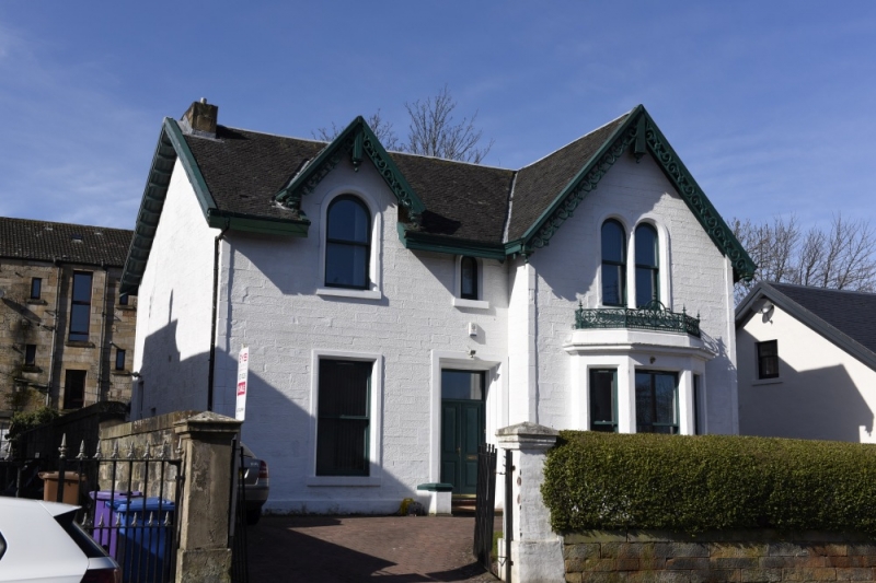
Mid/later 19th century. Bargeboarded Italianate villa with L-plan front: 2-storeys; stugged coursers, polished dressings; canted window to right with decorative cast-iron balcony, round arched 1st floor windows; end stacks, broad-eaved slate roof. Boundary wall to front and piers also ashlar.
External links are from the relevant listing authority and, where applicable, Wikidata. Wikidata IDs may be related buildings as well as this specific building. If you want to add or update a link, you will need to do so by editing the Wikidata entry.


Other nearby listed buildings
