Approximate Location Map
Large Map »
Latitude: 55.4197 / 55°25'10"N
Longitude: -2.7873 / 2°47'14"W
OS Eastings: 350262
OS Northings: 614257
OS Grid: NT502142
Mapcode National: GBR 85ZS.C0
Mapcode Global: WH7XN.41ZJ
Plus Code: 9C7VC697+V3
Entry Name: 7 Slitrig Crescent, Hawick
Listing Name: 7 Slitrig Crescent
Listing Date: 19 August 1977
Category: C
Source: Historic Scotland
Source ID: 378976
Historic Scotland Designation Reference: LB34658
Building Class: Cultural
ID on this website: 200378976
Location: Hawick
County: Scottish Borders
Town: Hawick
Electoral Ward: Hawick and Hermitage
Traditional County: Roxburghshire
Tagged with: Terrace house
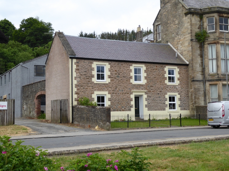
Circa 1815. 2-storey, 3-bay, gabled house formerly part of terrace. Smooth-rendered rubble with painted, tabbed, droved margins and polished red sandstone ashlar cills; pebbledash to rear. Base course; eaves course. Raised cills; raised long-and-short quoins to left of front elevation. 2 stone steps to central recessed door with multi-pane rectangular fanlight and cornice.
4-pane glazing in timber sash and case windows. Ashlar-coped skews. Grey slate roof. Cast-iron rainwater goods.
BOUNDARY WALLS: Shoulder-height, ashlar-coped boundary wall to N side of front garden; high ashlar-coped rubble boundary wall enclosing N side of rear courtyard, with red sandstone dressings to wide segmental-arched opening.
A well-proportioned, traditional, early-19th-century house which makes a significant contribution to the streetscape of Slitrig Crescent.
The ribbon development of private and industrial buildings along the south side of Slitrig Crescent was one of the town's first expansions beyond its medieval boundaries. The road was laid out circa 1800, and the various structures were built from 1815. The buildings to the rear comprised tanneries, dyeworks and textile mills, powered via a mill lade running behind them which has since been filled in.
Although it has been smooth-rendered to the front and significantly altered to the rear, and has had some stonework replaced, this house retains its original proportions and its timber windows. It was originally linked to another terraced building to the north, with a pend between the two; the north gable end has been refinished in brick after the removal of the adjacent building. List description revised following resurvey (2008).
External links are from the relevant listing authority and, where applicable, Wikidata. Wikidata IDs may be related buildings as well as this specific building. If you want to add or update a link, you will need to do so by editing the Wikidata entry.


Other nearby listed buildings
