Approximate Location Map
Large Map »
Latitude: 56.2296 / 56°13'46"N
Longitude: -5.0735 / 5°4'24"W
OS Eastings: 209577
OS Northings: 708367
OS Grid: NN095083
Mapcode National: GBR 00.CD75
Mapcode Global: WH1JP.1PB5
Plus Code: 9C8P6WHG+RH
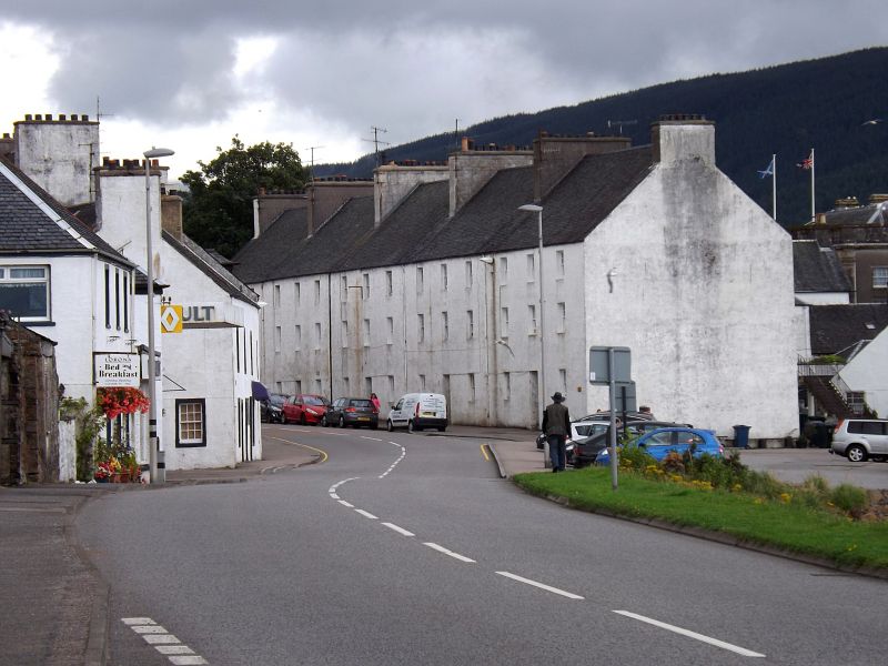
Entry Name: Relief Land, South Main Street East, Inveraray
Listing Name: Relief Land, 86 Main St. East
Listing Date: 4 August 1966
Category: A
Source: Historic Scotland
Source ID: 379442
Historic Scotland Designation Reference: LB34999
Building Class: Cultural
Also known as: Inveraray, South Main Street East, Relief Land
ID on this website: 200379442
Location: Inveraray
County: Argyll and Bute
Town: Inveraray
Electoral Ward: Mid Argyll
Traditional County: Argyllshire
Tagged with: Building
1779. Plain Georgian. Long block; 3 storeys. Harled;
gabled slate roof
5 outside stairs (modern) at rear.
Domestic. 5 tenements.
External links are from the relevant listing authority and, where applicable, Wikidata. Wikidata IDs may be related buildings as well as this specific building. If you want to add or update a link, you will need to do so by editing the Wikidata entry.


Other nearby listed buildings
