Approximate Location Map
Large Map »
Latitude: 56.2295 / 56°13'46"N
Longitude: -5.0742 / 5°4'27"W
OS Eastings: 209534
OS Northings: 708353
OS Grid: NN095083
Mapcode National: GBR 00.CD2V
Mapcode Global: WH1JP.1P08
Plus Code: 9C8P6WHG+Q8
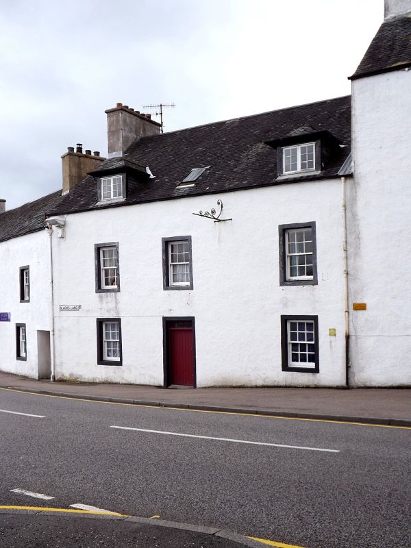
Entry Name: Backs Land, South Main Street West, Inveraray
Listing Name: Black's Land; S. Main St. W.
Listing Date: 4 August 1966
Category: A
Source: Historic Scotland
Source ID: 379444
Historic Scotland Designation Reference: LB35001
Building Class: Cultural
Also known as: Inveraray, South Main Street West, Backs Land
Jones' Land
ID on this website: 200379444
Location: Inveraray
County: Argyll and Bute
Town: Inveraray
Electoral Ward: Mid Argyll
Traditional County: Argyllshire
Tagged with: House Inn Architectural structure
Later 18th century.
Traditional.
2 storeys and attic; 3 windows wide.
Harled; gabled slate roof; 2 piended dormers (modern).
Domestic Also known as Jones's Land. (Jones was son-in-
law of Mackenzie) Formerly 'Halley's Inn'.
A group.
External links are from the relevant listing authority and, where applicable, Wikidata. Wikidata IDs may be related buildings as well as this specific building. If you want to add or update a link, you will need to do so by editing the Wikidata entry.


Other nearby listed buildings
