Approximate Location Map
Large Map »
Latitude: 56.2237 / 56°13'25"N
Longitude: -2.7003 / 2°42'1"W
OS Eastings: 356673
OS Northings: 703684
OS Grid: NO566036
Mapcode National: GBR 2V.CZ5N
Mapcode Global: WH7SM.HTCP
Plus Code: 9C8V67FX+FV
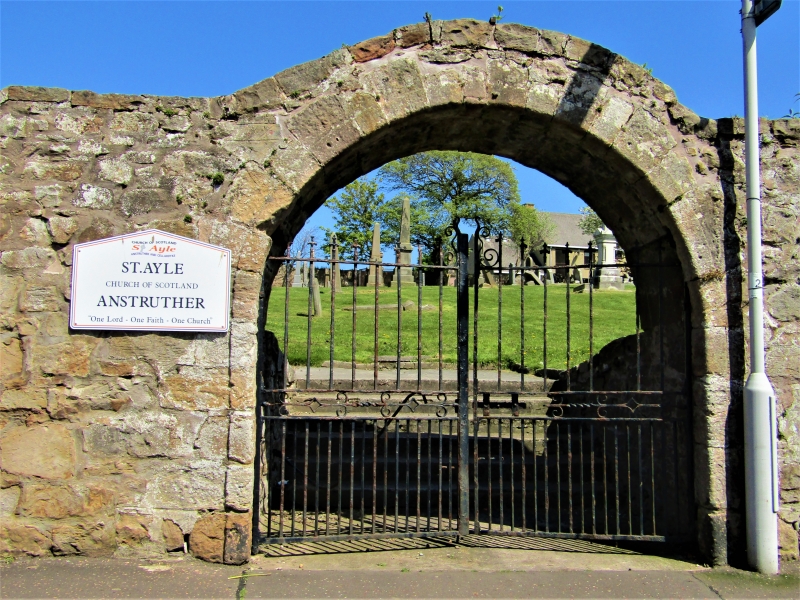
Entry Name: Churchyard Walls, St Adrian's Church, Anstruther Easter
Listing Name: St Adrian's Churchyard Walls and Monuments
Listing Date: 9 May 1972
Category: B
Source: Historic Scotland
Source ID: 380773
Historic Scotland Designation Reference: LB36067
Building Class: Cultural
ID on this website: 200380773
Location: Kilrenny
County: Fife
Town: Kilrenny
Electoral Ward: East Neuk and Landward
Traditional County: Fife
Tagged with: Architectural structure
1631. Arched entrance gates and rubble walls average 9' high, mural and other monuments 17th century onwards, but mainly modern.
External links are from the relevant listing authority and, where applicable, Wikidata. Wikidata IDs may be related buildings as well as this specific building. If you want to add or update a link, you will need to do so by editing the Wikidata entry.


Other nearby listed buildings
