Approximate Location Map
Large Map »
Latitude: 56.2232 / 56°13'23"N
Longitude: -2.7029 / 2°42'10"W
OS Eastings: 356512
OS Northings: 703627
OS Grid: NO565036
Mapcode National: GBR 2V.CYGW
Mapcode Global: WH7SM.GV42
Plus Code: 9C8V67FW+7R
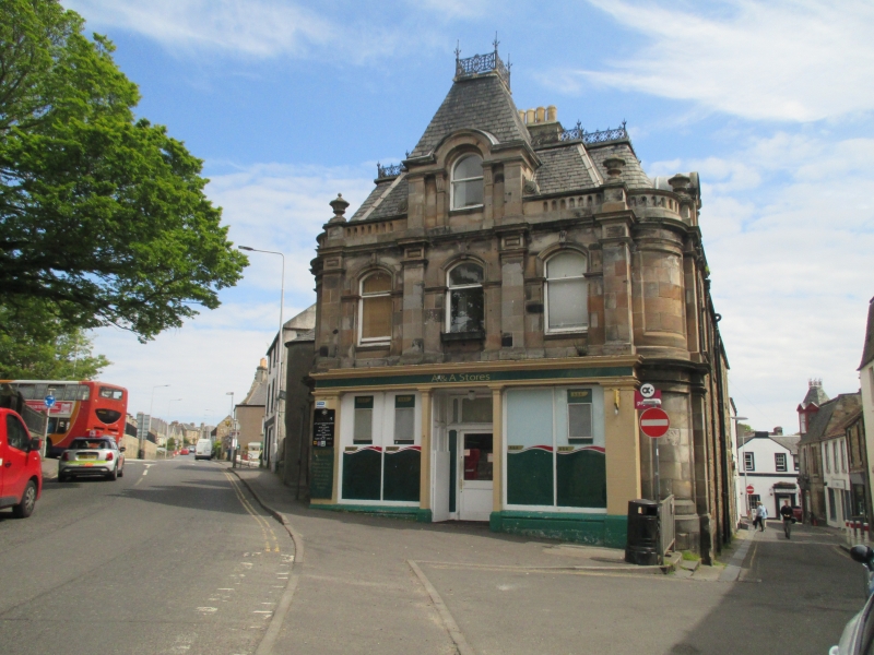
Entry Name: Dunearn, 24 High Street, Anstruther Easter
Listing Name: 24 High Street and "Dunearne" Anstruther Easter
Listing Date: 9 May 1972
Category: B
Source: Historic Scotland
Source ID: 380814
Historic Scotland Designation Reference: LB36102
Building Class: Cultural
ID on this website: 200380814
Location: Kilrenny
County: Fife
Town: Kilrenny
Electoral Ward: East Neuk and Landward
Traditional County: Fife
Tagged with: Architectural structure
Reconstructed late 19th century from older buildings.
2-storey and attic gusset block, rubble with Victorian
renaissance ashlar show front to W, pilastered ground floor
shop, curved angles and French roof with decorative cast-iron
work.
External links are from the relevant listing authority and, where applicable, Wikidata. Wikidata IDs may be related buildings as well as this specific building. If you want to add or update a link, you will need to do so by editing the Wikidata entry.


Other nearby listed buildings
