Approximate Location Map
Large Map »
Latitude: 56.2229 / 56°13'22"N
Longitude: -2.7015 / 2°42'5"W
OS Eastings: 356600
OS Northings: 703594
OS Grid: NO566035
Mapcode National: GBR 2V.CYVM
Mapcode Global: WH7SM.GVT9
Plus Code: 9C8V67FX+5C
Entry Name: 32 Rodger Street, Anstruther Easter
Listing Name: 34 Rodger Street Anstruther Easter
Listing Date: 9 May 1972
Category: B
Source: Historic Scotland
Source ID: 380845
Historic Scotland Designation Reference: LB36128
Building Class: Cultural
ID on this website: 200380845
Location: Kilrenny
County: Fife
Town: Kilrenny
Electoral Ward: East Neuk and Landward
Traditional County: Fife
Tagged with: Architectural structure
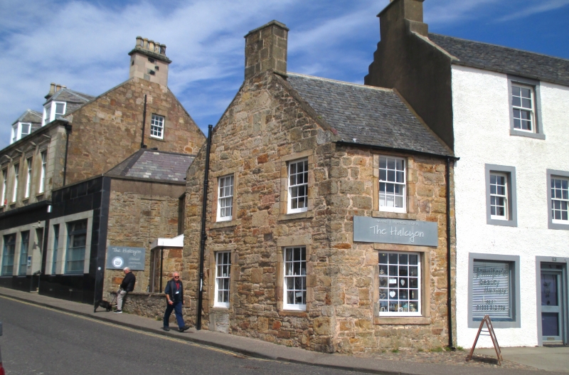
Circa 1827. Small 2-storey 2-window gable to Rodger Street,
1-window to Shore Street, rubble with painted margins,
ground floor shop: slated: 2-storey 2-window wing with timber
parapet pantiled to Rodger Street.
External links are from the relevant listing authority and, where applicable, Wikidata. Wikidata IDs may be related buildings as well as this specific building. If you want to add or update a link, you will need to do so by editing the Wikidata entry.


Other nearby listed buildings
