Approximate Location Map
Large Map »
Latitude: 56.2223 / 56°13'20"N
Longitude: -2.7054 / 2°42'19"W
OS Eastings: 356357
OS Northings: 703523
OS Grid: NO563035
Mapcode National: GBR 2V.CXVV
Mapcode Global: WH7SM.DVYT
Plus Code: 9C8V67CV+WV
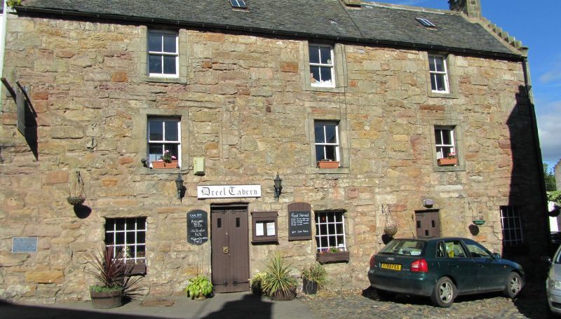
Entry Name: Railway Tavern, 14, 16 High Street West, Anstruther Wester
Listing Name: The Dreel Tavern 14 and 16 High Street Anstruther Wester
Listing Date: 9 May 1972
Category: B
Source: Historic Scotland
Source ID: 380947
Historic Scotland Designation Reference: LB36217
Building Class: Cultural
ID on this website: 200380947
Location: Kilrenny
County: Fife
Town: Kilrenny
Electoral Ward: East Neuk and Landward
Traditional County: Fife
Tagged with: Pub
17th and 18th centuries. 3-storey 3-window rubble with margins crowstepped and slated; ground floor stuccoed; back stair dated 1734.
Former Coaching Inn. Birthplace of Captain Charles Gray, RN.
External links are from the relevant listing authority and, where applicable, Wikidata. Wikidata IDs may be related buildings as well as this specific building. If you want to add or update a link, you will need to do so by editing the Wikidata entry.


Other nearby listed buildings
