Approximate Location Map
Large Map »
Latitude: 56.2222 / 56°13'19"N
Longitude: -2.7055 / 2°42'19"W
OS Eastings: 356347
OS Northings: 703516
OS Grid: NO563035
Mapcode National: GBR 2V.CXTL
Mapcode Global: WH7SM.DVWV
Plus Code: 9C8V67CV+VQ
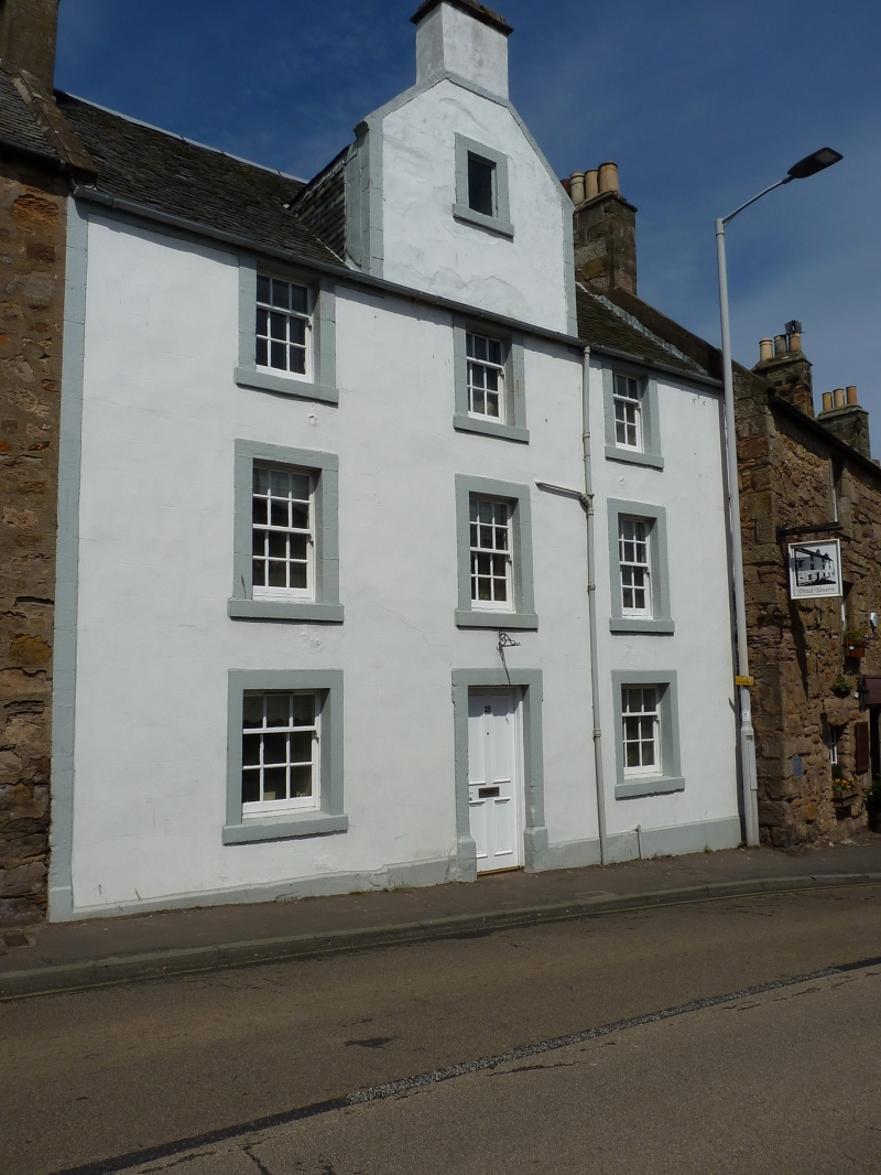
Entry Name: 18 High Street West, Anstruther Wester
Listing Name: 18 High Street Anstruther Wester
Listing Date: 9 May 1972
Category: B
Source: Historic Scotland
Source ID: 380948
Historic Scotland Designation Reference: LB36218
Building Class: Cultural
ID on this website: 200380948
Location: Kilrenny
County: Fife
Town: Kilrenny
Electoral Ward: East Neuk and Landward
Traditional County: Fife
Tagged with: Architectural structure
Later 18th century. 3-storey 3-window stuccoed with painted
margins, wall-head attic gablet slated.
External links are from the relevant listing authority and, where applicable, Wikidata. Wikidata IDs may be related buildings as well as this specific building. If you want to add or update a link, you will need to do so by editing the Wikidata entry.


Other nearby listed buildings
