Approximate Location Map
Large Map »
Latitude: 54.8366 / 54°50'11"N
Longitude: -4.0492 / 4°2'56"W
OS Eastings: 268489
OS Northings: 551010
OS Grid: NX684510
Mapcode National: GBR 0D5J.50
Mapcode Global: WH4WB.SP0K
Plus Code: 9C6QRXP2+J8
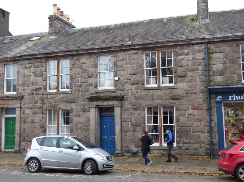
Entry Name: 27 St Mary Street, Kirkcudbright
Listing Name: 27 St Mary`s Street
Listing Date: 28 May 1981
Category: B
Source: Historic Scotland
Source ID: 381427
Historic Scotland Designation Reference: LB36609
Building Class: Cultural
ID on this website: 200381427
Location: Kirkcudbright
County: Dumfries and Galloway
Town: Kirkcudbright
Electoral Ward: Dee and Glenkens
Traditional County: Kirkcudbrightshire
Tagged with: Architectural structure
Circa 1860. Terraced house. 2-storeys, 3-bays. Rock faced sandstone with polished sandstone dressings. Centre pilastered door with flanking bipartites. Central window in 1st floor, flanked by bipartites, all with astragals. Corniced ridge stacks, slate roof.
B Group with items 152-55, 157 and 158
External links are from the relevant listing authority and, where applicable, Wikidata. Wikidata IDs may be related buildings as well as this specific building. If you want to add or update a link, you will need to do so by editing the Wikidata entry.


Other nearby listed buildings
