Approximate Location Map
Large Map »
Latitude: 56.6734 / 56°40'24"N
Longitude: -3.0032 / 3°0'11"W
OS Eastings: 338625
OS Northings: 753962
OS Grid: NO386539
Mapcode National: GBR VJ.MNC7
Mapcode Global: WH7QB.VJ3G
Plus Code: 9C8RMXFW+9P
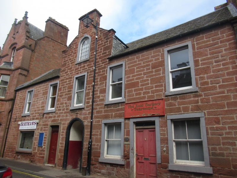
Entry Name: 17 Bank Street, Kirriemuir
Listing Name: 13-17 Bank Street
Listing Date: 11 June 1971
Category: B
Source: Historic Scotland
Source ID: 381739
Historic Scotland Designation Reference: LB36856
Building Class: Cultural
ID on this website: 200381739
Location: Kirriemuir
County: Angus
Town: Kirriemuir
Electoral Ward: Kirriemuir and Dean
Traditional County: Angus
Tagged with: Architectural structure
Circa 1800. 2-storey 5-window coursed rubble with margins,
centre wallhead gable with round-arched attic window having tracery-headed sash, vaulted close: slated. One ground floor
window widened for shop. 2 wings at back, stair in E angle.
B group with items 1-32.
External links are from the relevant listing authority and, where applicable, Wikidata. Wikidata IDs may be related buildings as well as this specific building. If you want to add or update a link, you will need to do so by editing the Wikidata entry.


Other nearby listed buildings
