Approximate Location Map
Large Map »
Latitude: 55.674 / 55°40'26"N
Longitude: -3.7816 / 3°46'53"W
OS Eastings: 288051
OS Northings: 643716
OS Grid: NS880437
Mapcode National: GBR 221T.2V
Mapcode Global: WH5SJ.WND3
Plus Code: 9C7RM6F9+H9
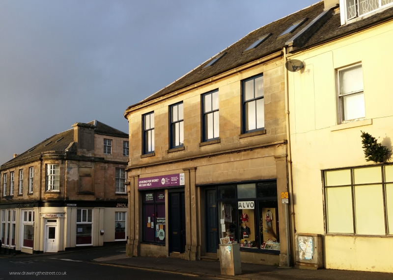
Entry Name: 38-42 Bloomgate, Lanark
Listing Name: 42 Bloomgate
Listing Date: 7 May 1980
Category: C
Source: Historic Scotland
Source ID: 381850
Historic Scotland Designation Reference: LB36943
Building Class: Cultural
ID on this website: 200381850
Location: Lanark
County: South Lanarkshire
Town: Lanark
Electoral Ward: Clydesdale North
Traditional County: Lanarkshire
Tagged with: Architectural structure
Circa 1830. 2-storey corner block with Hope Street. Ashlar
with modern shop fronts. 4 windows to 1st floor with
altered glazing. 1 window and 1st floor on shallow
recessed curve. Cornice, piended slate roof. 9 windows to
Hope Street - see 4, 6, 8, 10 Hope Street.
Listed for group and balancing curved angle with No 44.
External links are from the relevant listing authority and, where applicable, Wikidata. Wikidata IDs may be related buildings as well as this specific building. If you want to add or update a link, you will need to do so by editing the Wikidata entry.


Other nearby listed buildings
