Approximate Location Map
Large Map »
Latitude: 55.15 / 55°8'59"N
Longitude: -2.997 / 2°59'49"W
OS Eastings: 336561
OS Northings: 584412
OS Grid: NY365844
Mapcode National: GBR 78HW.ZP
Mapcode Global: WH7YP.YT1B
Plus Code: 9C7V42X3+X6
Entry Name: House, Drove Road, Langholm
Listing Name: Drove Road, House Opposite Number 26
Listing Date: 12 July 1988
Category: C
Source: Historic Scotland
Source ID: 382091
Historic Scotland Designation Reference: LB37111
Building Class: Cultural
ID on this website: 200382091
Location: Langholm
County: Dumfries and Galloway
Town: Langholm
Electoral Ward: Annandale East and Eskdale
Traditional County: Dumfriesshire
Tagged with: Architectural structure
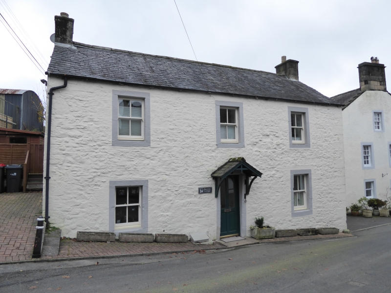
Probably late 18th century. 2-storey, 3-bay house. Painted
rubble with contrasting ashlar margins; central boarded door
with fanlight, sash windows with 4-pane glazing pattern, end
stacks, slate roof.
Garage abuts E gable.
B Group.
External links are from the relevant listing authority and, where applicable, Wikidata. Wikidata IDs may be related buildings as well as this specific building. If you want to add or update a link, you will need to do so by editing the Wikidata entry.


Other nearby listed buildings
