Approximate Location Map
Large Map »
Latitude: 55.1229 / 55°7'22"N
Longitude: -3.3564 / 3°21'22"W
OS Eastings: 313598
OS Northings: 581787
OS Grid: NY135817
Mapcode National: GBR 5906.4D
Mapcode Global: WH6XL.DHYK
Plus Code: 9C7R4JFV+5F
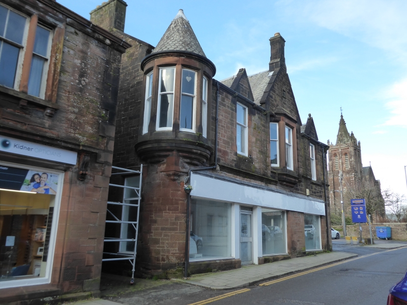
Entry Name: 7-11 High Street, Lockerbie
Listing Name: 7-11 (Odd Nos) High Street
Listing Date: 4 October 1988
Category: C
Source: Historic Scotland
Source ID: 382683
Historic Scotland Designation Reference: LB37565
Building Class: Cultural
ID on this website: 200382683
Location: Lockerbie
County: Dumfries and Galloway
Town: Lockerbie
Electoral Ward: Annandale North
Traditional County: Dumfriesshire
Tagged with: Architectural structure
Late 19th/early 20th century. 2-storey commercial and
domestic block. Built of red ashlar. Inner wall-head gable
with apex stack; conical-roofed turret left corbelled above
ground floor. Slate roofs.
External links are from the relevant listing authority and, where applicable, Wikidata. Wikidata IDs may be related buildings as well as this specific building. If you want to add or update a link, you will need to do so by editing the Wikidata entry.


Other nearby listed buildings
