Approximate Location Map
Large Map »
Latitude: 55.1211 / 55°7'15"N
Longitude: -3.3558 / 3°21'20"W
OS Eastings: 313631
OS Northings: 581584
OS Grid: NY136815
Mapcode National: GBR 5907.UF
Mapcode Global: WH6XL.FJ7Y
Plus Code: 9C7R4JCV+CM
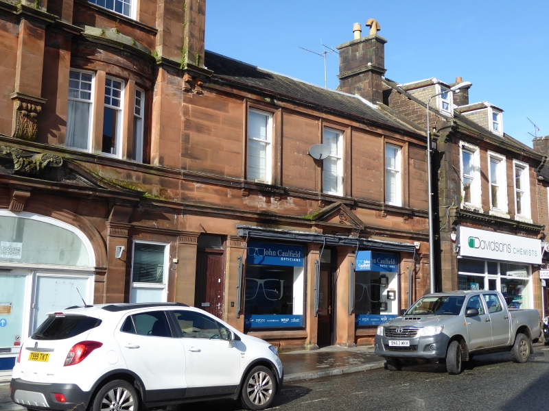
Entry Name: 77-79 High Street, Lockerbie
Listing Name: 77, 79 High Street
Listing Date: 4 October 1988
Category: B
Source: Historic Scotland
Source ID: 382691
Historic Scotland Designation Reference: LB37573
Building Class: Cultural
ID on this website: 200382691
Location: Lockerbie
County: Dumfries and Galloway
Town: Lockerbie
Electoral Ward: Annandale North
Traditional County: Dumfriesshire
Tagged with: Architectural structure
Built circa 1900. 2 storeys, 3 bays. Polished red ashlar.
Pilastered ground floor with original 3-bay shop front with
pedimented door, central door at left to flat above.
Architraved 1st floor windows all plate glass sashes and
with corbelled cills and continuous cill band. Eaves band;
skews; corniced end stack; slate roof.
Part of same design as Bank, adjoining.
External links are from the relevant listing authority and, where applicable, Wikidata. Wikidata IDs may be related buildings as well as this specific building. If you want to add or update a link, you will need to do so by editing the Wikidata entry.


Other nearby listed buildings
