Approximate Location Map
Large Map »
Latitude: 55.5994 / 55°35'57"N
Longitude: -2.7261 / 2°43'34"W
OS Eastings: 354341
OS Northings: 634215
OS Grid: NT543342
Mapcode National: GBR 93DP.LL
Mapcode Global: WH7WQ.3J38
Plus Code: 9C7VH7XF+QG
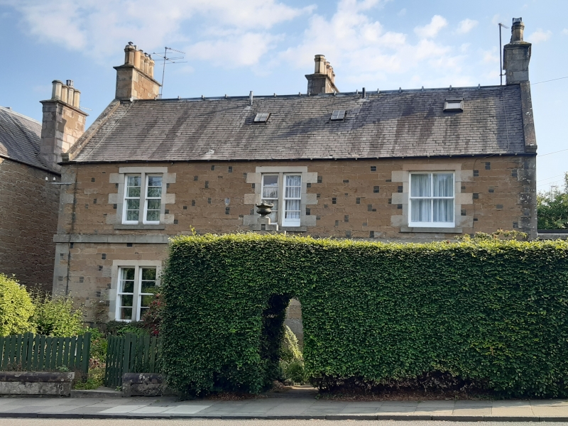
Entry Name: Elliot Lea, High Street, Melrose
Listing Name: High Street, (South Side) Elliotlea and Booklaws
Listing Date: 19 February 1981
Category: C
Source: Historic Scotland
Source ID: 382944
Historic Scotland Designation Reference: LB37789
Building Class: Cultural
ID on this website: 200382944
Location: Melrose
County: Scottish Borders
Town: Melrose
Electoral Ward: Leaderdale and Melrose
Traditional County: Roxburghshire
Tagged with: House
Later 19th century, 2 storey, 3 bay two house block with mutual crowstepped gabled porch at centre of ground floor, windows originally all bipartites, mullions removed from windows in right hand bay. Courced squared rubble with random whin blocks. Straight skews, rectangular coped end-stacks, slated roof.
B Group.
External links are from the relevant listing authority and, where applicable, Wikidata. Wikidata IDs may be related buildings as well as this specific building. If you want to add or update a link, you will need to do so by editing the Wikidata entry.


Other nearby listed buildings
