Approximate Location Map
Large Map »
Latitude: 55.9423 / 55°56'32"N
Longitude: -3.0546 / 3°3'16"W
OS Eastings: 334223
OS Northings: 672642
OS Grid: NT342726
Mapcode National: GBR 2F.YPP3
Mapcode Global: WH7TT.1WPX
Plus Code: 9C7RWWRW+W4
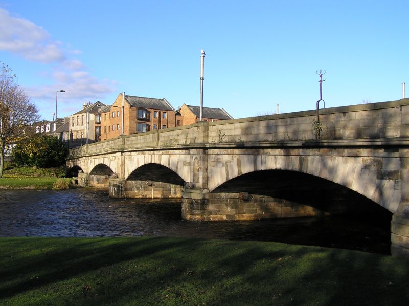
Entry Name: New Bridge, Musselburgh
Listing Name: New Bridge Between Bridge Street and High Street
Listing Date: 22 January 1971
Category: B
Source: Historic Scotland
Source ID: 383623
Historic Scotland Designation Reference: LB38363
Building Class: Cultural
ID on this website: 200383623
Location: Musselburgh
County: East Lothian
Town: Musselburgh
Electoral Ward: Musselburgh
Traditional County: Midlothian
Tagged with: Road bridge
1806-7, Sir John Rennie, widened 1924, Blyth & Blyth. 5
segmental arches. Ashlar on channelled cut-waters with
niched piers above. Cornice at pavement level with solid
parapet having advanced base course and deep coping above.
Built for Edinburgh-Berwick-London post road.
External links are from the relevant listing authority and, where applicable, Wikidata. Wikidata IDs may be related buildings as well as this specific building. If you want to add or update a link, you will need to do so by editing the Wikidata entry.


Other nearby listed buildings
